Wednesday, September 25, 2013

McLeod in a day (fail!).

Despite lingering Achilles tendonitis in both legs that sprung up after the Rut, I did my best to participate in an active recovery, including some slow runs on the Sentinel fire road, as well as a time trial on the Sentinel hill climb with Brian Story.  Trying to keep up with Brian (and failing) led me to a new PR on that section in 25:10, despite the fact that my Achilles were notably upset with me.

With the forecast heading south for this week, I wanted to get in a solid effort on Saturday.  My legs were feeling okay, so I opted for an attempt on the highest mountain in the Rattlesnakes, McLeod Peak (8620'), via the second highest (named) mountain, Murphy Peak (8167'), and Point Six.

I started from the Snowbowl base at 7:00, and started running up the gated access road.  Immediately, I was hit with some Achilles pain, but they didn't seem to be stiffening up or getting worse, so I just walked the steeps and tried to not worry about it.  I made it to the top of Point Six in 1h08m at a relaxed pace.  I've never climbed Snowbowl before (except the skin track during winter once), so I didn't know any of the myriad routes that would have been faster and better than this one.  Retrospectively, I should have just hiked up Paradise to N. Dakota Downhill or directly under Grizzly Chair.  I never realized that the Death Star was so goddam huge.  What do they keep in there?

The ridge run to Murphy went fast, and I got some great views of the snow-dusted Missions.  I am once again amazed at how much more snow they get than anywhere else.

Beyond Murphy, the ridge started to get spicy.  Eventually, I had to downclimb some loose class 3 to get around some gendarmes on the ridge.  This was some pretty chossy and sharp shale type junk, and the scree was too thin to ski, and the holds were all negative, so the going was sort of slow.  I hit a small col above Finley Lakes here, and then had to climb at the 4th class level some pretty solid pink quartzite to regain the ridge.  The climbing here was fun and rather exposed, but slow once again.  Things mellowed out here, and a few miles of straightforward ridge running and sidehilling finally brought me to the crux of the route, and the section that turned me back, two unnamed high points that look rather like bunny ears when viewed from Mosquito Peak.  The western ear is easily surmountable, with a nice talus gully leading up and over.  The ridge between the two was also plausible though exposed.  The eastern ear was highly exposed, wet (snowy on the N. sides!), and looked to be upper 4th, perhaps 5th class on loose rock, and more than I wanted to deal with solo and so far in the backcountry. 

I made a tentative effort to downclimb into the basin to the S., but ended up getting cliffed out.  4h30m into the day, with weather looking like it might deteriorate and plenty of scrambling left to do, I opted to turn around.  The scrambling on the way back went slowly again, and routefinding through the 4th class bit was trickier than going the other way.  I ended up back at Point Six at the 7h30m mark, and I took the Beargrass Highway back down, which is tremendously fun and fast running, and made it back to the truck around the 8 hour mark. 

I'm going to have to successfully summit now.  I've got a strong idea how to do it more easily now, mainly by bypassing most of the trickiness.  The ridge run is elegant and fun, but also slow, and the traverse to Sanders Lake across upper Grant Creek, despite the lack of trail, seems like it would be straightforward (I know it is during the winter).  From Sanders, I intend to contour around the ridge that extends south from the west rabbit ear, and from there, it's a simple matter to regain the ridge and climb it to McLeod.  Now just waiting for the weather window and the time.  Total distance for the day was 19 miles with 8000' vertical.  The complete route would be more like 23 miles with 10000'.

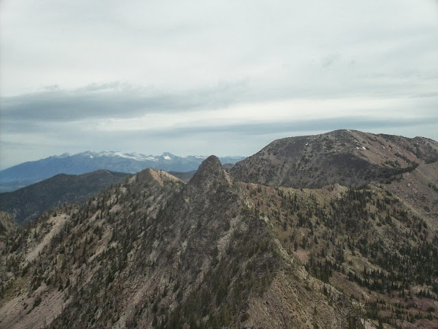
Snowy Missions from Murphy Peak.
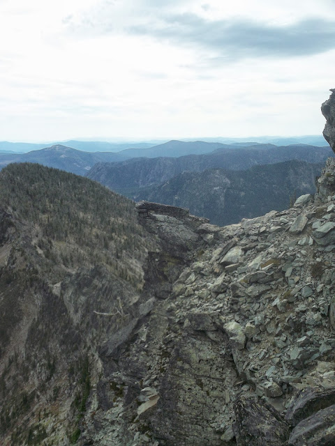
The East Rabbit ear from the west, looking difficult.

Klapperslange Tungen.

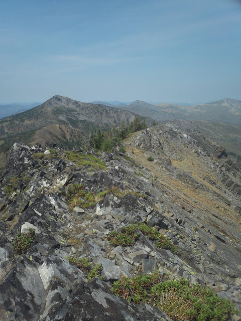
The way home.


Monday, September 16, 2013

The Rut 50k

On Saturday, I ran the Rut 50k in 6:05:43, which was enough for 8th place.  I had a really good time on this beautiful and difficult course, and I learned a great deal about how to train to do better next time and what some of my stronger and weaker skill sets are.  This being my first race ever (not just ultras; this was the first footrace of my life), I couldn't (reasonably) be any happier.  It happened like this.

Molly and I, having camped up Swan Creek, a big trib of the Gallatin, woke up at 4:45 to a solid drizzle, and I made a quick breakfast of 4 slices of bacon, some delicious Quebecois full strength yogurt (Liberte Brand), and a healthy scoop of nut butter.  We made the short drive up to the Big Sky base area, and picked up a bag of decent quality schweg as well as my race number, which was 23.  We sat around in the nice lodge, and I drank too much tea.  Mike the RD announced that lightning considerations were sufficiently tolerable to keep the climb up to Lone Peak as part of the course (there had been some doubt in the previous days.

Two minutes before the race start, people were still milling around, with a few people tentatively drifting towards the inflatable starting arch.  I felt presumptuous for doing it, but there was nobody really lined up at the front yet, so that's where I positioned myself (I gather that the front is usually where people who think they're going to win stand).  When the race started, I got excited and went out with the front runners, Pocatello's Luke Nelson setting the pace.  I even managed to stay with them for most of the first 1400' climb, but then I got dropped when we topped out on a flat road.  This section was pretty short, and then the race dropped down some steepish, pretty rocky single track that was a blast.  I made up a bit of time here, getting some of the leaders in view again, but they dropped me again when the course flattened out onto a vaguely downhill access road threading through some Moonlight Basin vacation properties. 

I was in eight-ish around this point and I didn't see anyone else for another six miles, well after the first aid station (which I didn't stop at because I had plenty of food and water).  Sometime around Mile 11, the eventual winner, Paul Hamilton, caught up with me and loped past effortlessly.  At the time, I thought that I had slowed down, but it turns out that he was just moving really fast.  I managed to maintain my position all the way to the next aid station, even passing someone on a short stretch of rocky downhill, although Brian Story and two others were creeping up on me and we ended up all reaching the Lone Peak tram dock around the same time.

I again made up a bunch of time running back downhill to the base of Bonecrusher ridge.  I had recognized at this point that I was generally slower on the flats and climbs than my pursuers, but notably faster on the descents.  I decided that leveraging this on the descent off of Lone Peak was probably wiser than blowing up trying to move too quickly to the summit, and maintained a pretty relaxed hiking pace to the top.  I was feeling it in my legs from the long, moderate switchbacking climb up to the tram dock, and in my lungs from the altitude (I never do any sustained running above 9000' while training in Missoula).  I got passed three times on the 2100' ascent to Lone Peak, but I made it to the summit within a minute of all of those that had passed me.  By the way, the ascent of Bonecrusher ridge must be one of the gnarlier sections of trail to be found in an American trail race, not that I have a basis for comparison.  It hits 40+ degrees towards the summit, with loose rock and good exposure off the right-hand side.  The wind was blowing, and the cloud deck made me feel like I was mountain climbing rather than racing. 

At the summit aid station, I learned that I was 30 minutes or so behind the front of the pack.  Obviously no chance of making that up with 12 miles to go, but it felt nice to hear that we weren't getting completely smoked.  I drank some Coca-Cola and started down the rocky, technical southeast ridge.  I consciously pushed hard down the ridge, taking some risks on the loose and wet rock (interesting geology through this section by the way).  I passed four people during the descent, and got a bunch of rocks in my shoes from scree-skiing down a little gully.  By the time I hit some flatter terrain towards the bottom, I had put at least 2 or 3 minutes on my nearest pursuer, time that I knew I would need to maintain my position if patterns from earlier in the day held. 

I reached the base of some lift (Swiftcurrent?) and a guy there told me that it was mostly jeep tracks to the finish.  This was not strictly true, but there were jeep tracks for a while.  I kept catching glimpses of Jeff Rome in front of me (and would for the remainder of the race), but was never able to make up any time on him.  Not much happened for the next five miles.  Some moderately ascending  roads gave way to some moderately descending single-track.  The ascent of Andesite Mountain to the last aid station was easy and fast, with the exception of the ascent of the Africa mountain bike trail, which included sections of clawing up near vertical mud walls.  I don't know how a person rides down it.  Someone had almost caught up with me before this bit, but I managed to put up a bit more of a lead through here and hit the final aid station with a reasonably comfortable pad.  The volunteers at all of the aid stations were wonderful, but these ones had been so nice as to learn my name, which was a surprising boost (to my ego, I guess).  Thanks guys.

I nearly sprinted out of the aid before realizing that doing so was laughably non-sustainable at that point, even on a downhill grade.  I still tried to push the steep single track as much as my legs would allow, but these last five miles were the least interesting of the race and I just tried to keep from slowing down.  I powerhiked a final climb, ran some rollers, and then had a mellow descent to the finish, where Molly and Louie were waiting.  I had suspected that I was in eighth for a while, but this was confirmed at the finish.

A few thoughts (about improving my own performance, probably not of much interest to anyone else):
1.  My training, especially the last month, wasn't really done properly.  I've been spending a great deal of time powerwalking ascents or hauling ass down technical stuff.  Both of these things helped (especially the technical descending), but most of the race was still just trail running.  I'm a relatively slow runner, and I don't climb (while running) all that well.  I need to do more straight trail running (and flatland speed training) to be competitive in these kinds of events.

2.  Cross-training is something I need to do, especially cycling.  I need more sustained time at VO2max.

3.  I was forced into a pretty long (2 week) rest period by various obligations before this race.  I called it a taper.  This was way too long, and I got stiff during that time.  This may or may not have hurt my performance, but is definitely increasing my recovery time.  Four or five days of tapering will probably be sufficient.

4.  Also on recovery, I had been a little lax in allowing grains back into my theretofore mostly grain free diet.  Again, may or may not have been detrimental to race performance, but almost certainly increasing recovery time.  Eating fewer gels is also appealing. 

5.  No caffeine within an hour of starting.


Monday, September 2, 2013


This was my final week before beginning to taper for the Rut.  I covered 67 miles and logged 25200' of climbing, much of which was high quality training (either high intensity, in difficult terrain, and/or in 90 degree heat.  Or I was hiking in a fairly relaxed way).  Really felt like I got something out of this set of runs, and I'm feeling very prepared (and stoked!) for the race. 

About that race...  I digitized the course for the Rut in Google Earth, essentially by tracing the existing Google Maps route that exists on its website, and extracted the elevation profile.  The distance is pretty close to the reported 50k.  The vertical reported by Google Earth, however, is just shy of 12000'.  Note that this is almost 4000' more than is reported.  I think that Google Earth elevation profiles often inflate vertical gain due to high-frequency trail undulations and errors in the GE DEM.  To counter this, I just measured from obvious low points to obvious high points and summed all of the climbs that had a vertical above 500' or so.  I got more or less the same result.  I can't say that I really mind.  I like vertical, and my training has tended towards more vertical and lower miles, because that's the kind of terrain that I find compelling.  I just hope that nobody gets sandbagged by an extra 50% of climbing (and descending) on top of an already significant figure. 

I'm also looking forward to a trip down the Main Salmon this coming weekend, with Molly, Louie, many friends, and (significantly) my brother, who's flying in from the East for his first river trip through the Idaho wilderness.   


08.26.13 Sentinel Hill Climb, 3mi, 2000', 41min:
25:30 up (PR), few minutes on top, about 13:00 down.  Done at around 1PM

08.27.13 Sentinel Hill Climb + University, 8mi, 3700', 1h30m:
26:45 up, then tagged the summit if University Mountain at 54:low.  Done at 4PM.

08.28.13 Sentinel Hill Climb + University, 14mi, 4800', 2h10m:
27 up, but then a much faster trip over to University, hitting the summit at 51:03 before running over to the South Side trails and running the fun singletrack of the Sam Braxton trail.  Started at 4:30.

08.29.13 Sentinel S + N, 6 mi, 1900', 52m:
Short evening run with Louie.  Finally cool enough for him to hang outside the early morning hours.

08.31.13 Williams Range Peaks, 9800' (+400'), 25mi (+3mi), 7h30m (+1h):
Finally managed to visit the rugged Williams Range, in the heart of the (proposed) Great Burn Wilderness.  Access for me was 12 miles off the northwest side of Lolo Pass.  I've been wanting to visit this region for a while, having seen its craggy peaks from both the south and north, as well as fished Cayuse Creek, Kelly Creek, Crooked Fork, and the Lochsa, which all have their origins in this knot of not especially high, but remarkably pristine and beautiful peaks in a corner of Idaho that sees very little traffic. 

I left the truck at 7:30, running through an open old Lodgepole grove that shared a glacial valley with the upper Crooked Fork.  After a few miles, the trail started climbing steeply up the east wall of the valley, and I quickly reached a saddle below Granite Peak (7551'), my first objective for the day.  This saddle was also the end of regular trail maintenance.  Granite Peak is about 2500' and 4 miles from the trailhead, and I reached its summit about an hour.  Climbing the solid rock pinnacles that give the peak its name was great fun and afforded excellent views of the route for the day, which would include both Shale Mountain (7612') to the north, and Rhodes Peak (7930', highest of the range) to the west. 

I followed the ridge from Granite to an unnamed high point, with intermittent aid from a very old and very underutilized horse track, and from there headed north to Shale, losing and regaining a lot of elevation in the process.  The ridgelines were mostly bare, due to the fire that sterilized the soil in 1910, and from which the vegetation has not yet recovered.  The lack of vegetation also allowed a great deal of erosion to occur, and the ridges were sometimes composed of almost beach-like sand, and sometimes of bunchgrasses.  Hoodoos of resistant granite protruded haphazardly, but didn't present the same kind of obstacles that ridgetop outcrops do in the Bitterroot Mountains.  I was back to the highpoint connecting Shale and Rhodes just before the 4 hour mark, and made a conscious effort to push hard to Rhodes, finding a decent section of trail for a little ways.  The trail once again petered out though, and I ended up taking a fairly inefficient to the south ridge of Rhodes, and from there the summit.  Below Rhodes, I found the only (only!) water of the day (except at the very beginning), a little spring of tepid water in the hanging valley east of Rhodes Peak.  It was low quality water, but a joy nonetheless, having been dry for almost two hours.  Now that I knew the routes, I ran the 10 or so miles back to Granite Peak relatively quickly, and from there, the descent down the open pine forests and good trail was a gas.

I reached the truck in good spirits (from eating enough sugar during the day) and time to spare to reach Lolo Pass, where I was to meet Molly to go camping.  We ended up visiting the Elk Summit area, taking a good hike that evening out to an overlook from which views of the West Fork of Moose Creek and its mountains were visible.      


09.01.13 Friday Pass, 2600', 8mi, 5h:
Great hike from the Kooskooskia Meadows trailhead, near Elk Summit.  Pretty lakes (but no fish), and awesome views of the Roots and Graves Peak.  

Granite Peak summit.

Hoodoo with Rhodes Peak.

Shale Mountain summit.

Rhodes Peak summit view, with Ranger Peak in the distance.

Ain't nothing says America like a Mule hitched to a flagpole.

A pleasingly symmetric Graves Peak.

Making waves in Swamp Lake.


Tuesday, August 27, 2013

Getting esoteric.

Two aggregately moderate, but high intensity weeks of 74 miles with 18900' of gain, and 79 miles with 21100' of gain. 

08.13.13 Lolo Peak from Mill Creek Trhd., 19mi, 6500', 3h34m11s:
I've found that I spend too much time driving up the Mormon Peak road when I go to Lolo peak, and that doing this is really just short-changing my training efforts.  The alternative is to start at the Mill Creek trailhead, which is on the Lolo Creek valley bottom, at around 3600' (as opposed to the standard trailhead at 5800').  This adds an additional 2200' of runnable vertical, and about 5 miles to the trip.  It also allows for a descent of the Mill Creek trail, which is one of the Missoula area's better mountain bike trails (so I hear), and is just as fun on foot.  I decided to make this into a loop, ascending Lantern Ridge, which ascends Lolo Peak's west side, and descended the standard Carlton Ridge to Mill Creek Trail route.  I pushed hard both up and down, and was really happy to have solidly broken the 4 hour mark, despite off trail travel on Lantern Ridge.  In fact, my time from the much lower trailhead was not much slower than my times on the standard route.  Regrettably, running fast on the descent put a big strain on my calves in the way that I'm not used to, and definitely left me hurting for the next few days.
 
08.14.13 Gully Loop, 4mi, 900', 50m:
So slowww.

08.15.13 Double Dip + Etc., 14mi, 4900', 2h15m (injury):
I ran the Double Dip course but with the addition of a second summit of Sentinel after running to the M, and a descent down the Pengelly trail.  About the time I started descending from the south summit, my calf started screaming, and I walked the rest of the way home.   

08.17.13 Rattlesnake Corridor Loop, 31mi, 5100', 4h55m:
After a day off, my calf seemed alright, and I decided to give this long run an attempt.  The route ascends to Stuart Peak from the main Rattlesnake trailhead, then drops down the backside into Lake Creek, before intersecting with the Corridor road for a 15 or 16 mile slog out on the rocky old dirt road.  Everything until the corridor was lovely (although I took the descent down the Lake Creek trail easy to avoid reinjuring my leg way the hell in the backcountry).  Running the entire corridor is an exercise in boredom, and I doubt I will ever do this again.

08.18.13 Fishin' up Colt Killed!, 6mi, 500', All Damn Day:
Some good, solid dog-wrangling, cutthroat harrasing fly fishing on the west side of the Bitterroots.  I count these recovery hikes as training, just try and stop me.

08.20.13 Straight Peak, 22mi, 5600', 4h49m:
I've been wanting to do this loop in the Great Burn for some time,  but the logistics and inclination never worked out before today.  The route begins at the Clearwater Crossing trailhead at the end of the W. Fork Fish Creek road.  I ended up ascending the lovely W. Fork Fish Creek trail before cutting off on the endless switchbacks that lead up to Cedar Mountain and the ridge separating West Fish from Straight Creek.  I was skeptical of the quality of this trail, but it turns out that it has been really well maintained.  From here, the run up the ridge to Straight Peak is straightforward (although I heard a cougar screaming nearby and that was spooky).  The top of Straight Peak is lovely, with views south to the Williams Range, and the imposing South Face of Crater Mountain dominating the view to the north.  What a slab of uninterrupted rock that is.  I look forward to skiing it at some point.  The descent to Chilcoot Pass from Straight Peak was a little confusing, with the trail becoming rather indistinct.  It's not really a problem because the ridge is perfect for overland travel, I just kept second guessing myself about finding the Straight Creek trail.  The egress out Straight Creek is rather long, rocky, and really brushy, and the trail is engineered in a strange way where it slithers back and forth over the broad valley bottom for no identifiable reason.  It crosses the creek six times, and most of these require wet shoes.  The brush was pretty bad for much of the time, which always makes me grumpy, and by the time I got back to the truck, my scratched legs and soggy feet had my feeling an uncharacteristic degree of animosity towards Straight Creek, despite the fact that this route should not be that strenuous. 

08.21.13 Gully Loop, 4mi, 900', no time:

08.22.13 AM University Mountain, 8mi, 2600', 1h10m:  
It's finally cooled off enough to bring the dog in the morning, and he is pretty stoked.  He's also relatively out of shape and was tired at the end of this one.  But he wasn't too hot. 

08.22.13 PM Sentinel Hill Climb, 5mi, 2000', 45m:
Sentinel Hill Climb in 25m31s, by best time thus far (but still poor, from a competitive perspective).  I keep thinking I should use poles, but is that cheating!?

08.24.13 Anaconda Hi-Line Loop, 35mi, 8000', 7h01m:
This was a beautiful and naturally constructed long loop in the Anaconda Range at the headwaters of the iconic rock creek.  The route essentially circumnavigates Warren Peak, crossing five passes of varying magnitudes (and the continental divide twice!).  Despite the long drive from Missoula, I strongly recommend this one.  I ran the loop clockwise in order to give myself bail options in the event of (forecasted) thunderstorms.

I left Missoula at 4:30, and arrived at the Carpp Creek Trailhead around 7:15.  I left the truck at 7:30, and immediately took a wrong turn and had to bushwhack around the creek bottom until finding the trail leading up towards Maloney Basin and Cutaway pass.  The trails in the Anaconda-Pintlers are really well maintained (although sometimes technical) and I had a pleasant time making the initial 2500' climb to 9600' Cutaway Pass along well groomed, low-angle switchbacks.  Some of the switchbacks even had tent pads built right in, in case you get tired, or just wanted to spend some time looking at the Teton-esque Warren Peak.  That's how nice the AP trail crews are.  The highpoint (and highlight) of the route (actually well above the named Cutaway Pass) was well above treeline, and the trail was just a trough dug out of the talus, which was fun to try to move efficiently over in minimal shoes.  The descent into LaMerche Creek was really pleasant, the perfect angle for high velocity cruising.  I followed the creek up to Warren Lake and from there up to the second pass of the day.  The trail down from here into Fishtrap Creek was technical, rooty, and fun, losing alot of elevation quickly that is then gradually regained with the long and rolling forested ascent towards Rainbow Pass.  The views to the Pintler Peaks from Rainbow pass are grand, with craggy peaks and lakes in all directions.  The descent to Johnston Lake and the run around the west side of the Warren massif are unremarkable; I lost some energy running through burns and the seemingly endless uphill slog towards Porter Ridge, although the extensive talus moonscapes were interesting.  From Porter Ridge, I dropped into the Tamarack Creek basin, which is full of sinuous, technical tread and granite erratics.  I was sort of going through a dark patch through this stretch; it would be a blast to run while feeling good.  A climb over a ridge leads into the Carpp Lakes basin, which is very likely the most popular location in the Anacondas.  A logical extension from here would be to ascend to Warren Pass and descend the Maloney Basin back to the trailhead.  I considered it but decided that between building thunderheads and friends to see back in town, that it should wait until next time.  The trail from Carpp Lake back to the Carpp Creek trailhead was relatively buff, and I was happy to find that I still had sufficient energy to run this stretch fast.  I want to go back and climb all the peaks and fish all the lakes.

08.25.13 Kid Lake Huckleberry Picking and Wood Gathering, 5mi, 1000', Even longer:
Molly, Louie, and I went to our favorite huckleberry spot and loaded up, and did a little bit of unproductive fishing.  We also started our fall firewood collection in earnest, cutting about a cord's worth of long rounds (we buck at home), using only axe and crosscut saw, per usual.  A strong and sudden afternoon thunderstorm over the ridge added some excitement as we scrambled to load the wood onto the trailer before getting electrocuted.  Even Louie was giving us concerned looks.

Warren Peak from one of the convenient rest stops on the ascent to Cutaway Pass.

Warren's unnamed twin above Warren Lake.

Anaconda Moonscape.

Louie being all uncertain about his Wolf Pack.  He won't tell you about it, but he's calculating his loss of aerodynamicy and increased surface area, and how that will affect his chipmunk hunting efficiency.


Monday, August 12, 2013

Narrowly avoiding big round numbers.

Managed a few enjoyable long runs in three different ranges this past week, as well as some shorter high-intensity outings close to home.  Total mileage for the week was 97 miles with 29800' of gain.  Done in around 19h30m. 

08.05.13 Sentinel Hill Climb + Etc. 12mi, 3300', 1h45m:
Did the M to Ridge Trail to the summit in just under 27 minutes, which is respectable, but not particularly fast.  I did this at around 5PM and definitely felt the heat.  Then some cruising around some of the less frequented trails of the Sentinel massif.

08.06.13 Mosquito Peak via Stuart Peak, 26mi, 7000', 4h15m:
Tagged the Summit of Mosquito, bypassing Stuart Peak on the way out, tagging its summit on the way back.  This was my first trip up Mosquito during the summer and with good visibility, and the views are really remarkable, with many of the Rattlesnake basin lakes visible.  The massive McCleod Peak dominates the viewshed, and I'm again inspired to try and reach the top of it, which there is no really easy way to do.  The trail is fast and flowing, and the descent from Stuart always goes faster than I expect it should.  I took some superfluous detours off trail before reaching Mosquito; I think that this will go under 4 hours next time. 

08.07.13 Fire Road Intervals, 6mi, 40m:
Standard stuff.

08.08.13 Lolo Peak, 14mi, 4900', 2h51m:
Up and down as quickly as possible (for me).  Splits:
0:51 Vista Point
1:31 North Summit
1:39 South Summit
1:47 North Summit
2:20 Vista Point
What this tells me is that I need to learn how to go much faster downhill.  The last mile before the trailhead, I started hitting the pace that I wanted, probably somewhere between 5 and 6 minutes.  Now I just need to do that all the time.

08.09.13 Sentinel Hill Climb + Etc., 10mi, 2500', 1h30m:
Slow hill climb (29m) and some pretty relaxed jogging around the mountain. 

08.10.13 Mineral Hill + Pt. 8098 + Echo Peak + Iron Mountain + Daly Peak, 25mi, 10100', 7h55m:
Long tour in the Scapegoat, making a loop above Kleinschmidt flats and hitting most of the major summits between the East Fork of the North Fork and the Big Blackfoot.  The bypass trail around the east side of Cooper's Lake is weird and unintuitive and took a long time.  Windy Pass is cool, and the views from Mineral Hill are worth the difficulty of getting there.  Everything between Windy Pass until after Daly Peak was overland, with a significant amount of Krumholz-whacking, as well as a little bit of 3rd class, particularly dropping from Daly into Dry Creek.  A significant portion of the terrain was not runnable, and I felt like I hiked half the day.  Despite the length and relatively stout vertical, I felt really good at the end of this one.

08.11.13 Gully Loop, 4mi, 1000', 36m:
I had big aspirations to do an additional long run this day, but friends from California were in town, and we decided to boat the Alberton Gorge instead.  Still managed a small run in the evening, but not quite enough for either 100 miles for the week, or 30k vertical. 


Snowbowl backcountry from Mosquito Peak.

Mineral Hill from the east.

Mineral Hill (Center) and Echo Mountain (Left) from Daly Peak.
Big McCleod and the upper Rattlesnake.


An uncomfortable recovery week 7.29-8.4

A trip to Austin for work necessitated a fairly mellow week of training, simply due to time constraints.  Totals of 50 miles with 6900' of gain. 

07.30.13 Double Dip Course, 13mi, 3000', 1h57m:
Ran this depletion style, imbibing no calories or water before or during.  I took a solid tumble while descending Smokejumper, skinning both knees, both shoulders, and (somehow) my forehead.  Managed a good tuck and roll, but ended up coming to rest with my head in the middle of the trail and both feet upslope and against a sapling.  Already feeling sort of hypoglycemic, I had to take a minute.

07.31.13 AM Fire Road Intervals, 6mi, Didn't time:
Continued attempts to put some speed in my legs over the flats, a skill in which I am sorely lacking.  Felt a little shin pain after this one.

PM Sentinel S./N. + University + Etc., 10mi, 2500', Didn't time:
A result of feeling guilty about not climbing any hills for the day. 

08.01.13 Sentinel South Loop, 6mi, 1400', 42m:
PR by a bit on this one.

08.02.13 Circumambulation of Zilker Park via Shoal Creek, Austin, TX, 10mi(+5 sauntering), 1h20m:
After my flight to Austin, and a bit of work for the afternoon, I should have joined my co-workers in watching the country's largest colony of Mexican free-tailed bats take flight while being showered in guano.  Instead, I opted to take advantage of the 105 degree afternoon heat, 80% humidity, and concrete to inflict some rather severe discomfort upon myself.  Considerable shin pain at the end of this did not, however, dissuade me from an additional 5 mile late night journey around Austin's 6th St., the party hub of the city.  I feel a little bad for the hordes of rickshaw pedaling hipsters soliciting rides ... There are so many of them that they can't possibly make a decent living, even with the thousands of drunks. 

Monday, July 29, 2013

Being frightened of heights and bears.

Had a fairly eventful week, completing two longer outings which I've been interested in for a while, both of which ended up more exciting expected.

Summary statistics:
Distance: 94 miles
Vertical: 20900'
Hours: ~21

07.23.13 Double Dip Course, 13 miles, 3000', 1h50m:
Similar time for this course as last week, but with no cramp breaks.  Felt like I was doing good, but wasn't able to hit the speeds I wanted on the flats at the end.

07.24.13AM Crooked Trail, 5 miles, N/A, 40m:
Interval training to build up that flatland speed. 

07.24.13PM Sentinel S Summit, 6 miles, 1500', 45m:
I haven't done this run in a while and I PR'd by a few minutes without really trying.  It's good to see the times going down.

07.25.13 Big St. Joseph and Bass Creek, 18 miles, 6500', 6h30m:
I ran from the Bass Creek trailhead to the base of Big Joe's southeast face, and made the long march up to the summit.  I was feeling pretty sluggish from intervals, and I felt slow to the base of the face.  From there, it was 1500' of 2nd-3rd class up to the west ridge of the SE bowl, and just a walk from there to within a few hundred feet of the summit.  I ended up descending into the bowl itself to get some water, and rather than go back up to the ridge, I decided to take a gully up through the big cliff bands on the east side of Joe's summit block, which ended up being 4th class, and ended with a steep field of terrible loose scree and talus at the top.

Big Joe ascent route.
I signed the summit register, and was the first of 2013 to do so, though I'm sure others have been up here already.  Everyone in the register seemed to be recording their summit split, and it felt nice to record the fastest overall summit time in the register, 3:15 (although it could go much, much faster), and the fastest time from the Bass Creek trailhead by far (as opposed to the Little Joe trailhead, which cuts off a few thousand vertical and a mile or two).

The descent went easily until reaching the bottom 1500', where I erroneously decided to drop off the east side of the ascent ridge into the stream gully in hopes of finding an easier way down.  This way turned out to be slow and difficult, with featureless granite slabs getting steeper and steeper towards the creek.  The lower parts had my full attention as I downclimbed 4th class terrain into the slide alder choked stream bottom.  The thing about slide alder choked stream bottoms is that they're damn near impossible to make progress in, so I eventually managed to contour my way back around to the other side of the ridge, where I found the trail.  This whole affair took me a really long time.

I had intended to continue up the south side of Bass Creek to Lappi Lake and perhaps Lappi Peak, but after running up and down the trail where the junction was supposed to be for a few miles each way, I could not find the trail, and concluded to call it a day, with a fast run out the Bass Creek trail, dodging day hikers, as is standard practice for these popular trails.

The view south from Big Joe.  The only difference between this and all my other Bitterroot summit photos is that Big Joe isn't in this one.
    
07.26.13 Sentinel N, 5 miles, 1400', 55m:
North Sentinel summit.  The dog was hot so we went slowly.

07.27.13 Scapegoat Mountain Palisades, 37 miles, 5500', 8h:
North Fork Blackfoot trailhead to North Fork Cabin, up the Dry Fork, up Cabin Creek, down Dabrota Creek, down the North Fork Blackfoot, past North Fork Falls, and back to the trailhead.

The run to the cabin went quickly enough, and I was consciously keeping 10 minute pace, trying to be conservative since the run was the longest I've done by a fair margin.  Continuing up the Dry Fork, the trail stayed good, and the running was easy.  Made it to Cabin Creek at mile 10 in exactly 100 minutes, and from there turned northeast towards Scapegoat Mountain, which was visible 8 miles distant.  The Cabin Creek trail was not so good, and had much deadfall and fairly indistinct track.  Also, no one had been on it in a good while.  The trail follows a bench, and much like everywhere else in the Scapegoat, is surrounded by 25 year old trees. 

The creek bottom itself looked like good bear habitat, willows and patchy unburned timber with avalanche paths reaching the creek in a number of places, but the trail was following a bench, and I was glad to not be down there.  Predictably however, after two miles, the trail dropped into the head high willows, and the bear sign started appearing.  At first, it was mostly older scat, grizzly for sure, but not fresh.  As I progressed up the trail, it became fresher and fresher, until I found one that was certainly from the night before or that morning, as well as some rubs, and my hackles started rising.  So I did the only sensible thing, which was to stop running, and start walking slowly, making a lot of noise, and paying close attention to what was going on in the bushes around me.  And so I trod lightly for the next five miles, until the trail started climbing up out of the creek bottom.  Now, I'm generally cool with bears, but Cabin Creek made me uncomfortable.  Perhaps it was the remoteness, or the confining vegetation, or whatever, but it had me spooked, and I was relieved to get to the headwall.

The climb up to the Cabin-Dabrota divide was easy and the trail was good and distinct.  The wildflowers in the Scapegoat are in full effect right now, and the giant limestone palisades of Scapegoat Mountain along with the bursting Paintbrushes was classic Montana.
Wildflowers and a little piece of Scapegoat Mountain.

Cabin Creek

Scapegoat Palisades and Flint Mountain.
The run down Dabrota Creek to the North Fork was fast and nice through unburned forest (the only such of the route).  From there it was 13 miles back to the truck through burned, shadeless, south facing hillsides in the 90 degree heat of the day.  This bit was a slog, and I was tired and hot (but still running) upon reaching the truck.  I wish my legs had been a bit more cooperative towards the end, but they've never gone that far before.  Looking forward to trying a route of this length again, now that I know what I'm in for. 

07.28.13 N Sentinel/University Mountain/Crazy Canyon, 10 miles, 3000', 1h40m:
Slow recovery jog around the Sentinel Massif.  Felt surprisingly good after yesterday's long run.  Eating fish helps every time.


Monday, July 22, 2013

In the Missions and the Swans.

Closed out the week with three more outings for a weekly total of ~90 miles and ~27000' vertical.

I was quite tired from Pyramid Buttes Sweeney on Thursday, and just did a short run to the top of Sentinel on Friday with Louie.  He really has a hard time with the heat.  Even in the evening it's been in the mid to high 70s, and he can't deal with that.  So we went slowly.

07.20.13 Greywolf Peak, 14 miles, 6000', 9h:
On Saturday, I met up with friends Perry and Clair for an attempt on Greywolf Peak.  This spring, Perry and I skied Greywolf's classic west couloir, but this line does not include a summit visit.  This time we were hoping to climb the northeast ridge, which is the standard summer route. 

The trail from Twin Lakes was good (and clandestine), with minimal deadfall due to some kind and good person who cut out much of the lower trail.  I'm hoping to return this fall and finish cutting out the upper sections of the trail.  Formal trail maintenance?  The tribal side of the Missions have about three maintained trails, and these mostly stick to the lower country.  Anything that heads to a peak is covertly cleared by the dedicated group of skiers that frequent this range.  We climbed a ways through the timber, before crossing below a steep open fin (where a snowshoer was killed in an avalanche a number of years ago), and got this view:
Greywolf's south couloir.
The south couloir almost looked skiable still.  There is still a surprising amount of snow in the Missions.  More on that in a minute.  As we made our way up the basin, we were overcome by patriotism on account of this American Bald.
Majestic American Bald.
 I even took off my hat for a minute, at great risk of sunburn.  We crossed the Grizzly Lakes basin to a low pass in the southeast ridge:
Greywolf's SE ridge.
 After this, one must then cross the Scenic Lakes basin, and climb up onto a shelf to the northeast of Greywolf via a little 3rd class gully.  From there we made our way to the crux of the route, called the Notch, where the shelf gives way to the proper northeast ridge of Greywolf.  This section is typically rated high 4th class in ideal conditions.  I had already seen a bunch of snow in the notch, and also some snow peaking over the ridgeline, which did not inspire confidence, as we hadn't brought crampons or axes.  Sure enough, after descending some difficult rock, and crossing an airy catwalk to the notch proper, we found this enormous cornice still fully in play, effectively blocking the route through the notch:

Perry assessing the feasibility of downclimbing around the giant death cornice via its moaty bowels.
The pictures don't really do justice to the consequences of this terrain.  If one fell in either direction crossing that snow, death was pretty certain.  There was also a significant amount of snow still on the north ridge.  It would have been easy to navigate with crampons and an axe, but not being so equipped, the combination of exposure, difficult climbing, and non-ideal conditions provoked the decision to call it quits on the summit bid.  Despite being turned around 500' from the summit, the views were spectacular, and the journey to the notch is well worth the trip.  There is still so much snow in the Missions!  A dedicated skier could easily get several thousand feet of corn skiing in, and it's almost August.
Upper 4th class on the other side of the notch.

   
Airy sidewalks.
  
07.21.13 Holland Lake Loop, Somewhere between 24 and 28 miles, 7000', 5h05m:
I felt quite good after the hike up Greywolf, and decided to go for a longer run on Sunday.  I feel as though I've been doing alot of scrambling lately, which translates to alot of not running on these outings.  Thus, I resolved to go somewhere with trails the whole way, specifically trails that likely have been cleared in the last 2 years, so that I could see what it feels like to run continuously for the kind of distances I'm going to see in the upcoming race.  I was also inspired by the previous day's view of the incomparable Swan front to visit that range.  Holland Lake is a major access point, and I was able to determine a desirable loop route that would pass by three sets of jewelry themed lakes, as well as visit a decommisioned lookout. 

The drive from Missoula was long, and it was almost 9 by the time I left the truck.  I ran hard out of the gate and made it to Upper Holland Lake in about an hour, trying hard to push through the steeper technical sections.  From Upper Holland, it's only another 600' vertical to the first pass of the day, Pendant Pass, from which views of the interesting geology of Carmine Peak are excellent.
Belt shales on Carmine Peak.
From Pendant Pass, it was a fast and rocky schuess down to Big Salmon Creek with occasional views of red rocky breaks.  This was my first time in the Bob Marshall proper, and I am now really looking forward to coming back and fishing the lakes and these medium-sized creeks.  At the intersection of Big Salmon Creek and Smoky Creek (my route back up to the front), I ran into a giant party of hung-over cowboys, all of whom were wearing 10 gallon hats, chaps, sleeveless T-shirts, and pistols.  They were arranged in a giant dirt circle, and gave me hard looks when I ran past.  The run up Smoky Creek was standard fare until reaching the Necklace Lakes, when the timber opened up offering views north to Buck and Holland Peaks.
Buck.

Holland and friends.
Another 20 minutes had me on Necklace Pass, where a really steep and narrow spur trail takes off to the old Holland Lake lookout at 8000'.  This was my only walking of the day, which was really nice.  From the lookout, the amount of snow remaining in the southern Missions is obvious.  There remain several thousands of feet of snow below the Glacier Peaks (second from right in the snowy group), and on the East Face of MacDonald (rightmost member of the snowy group). 
Snow in the Southern Missions.

 Although these peaks are not much higher than the Swan crest, the amount of snow ice decidedly different, as is obvious by these views north and south.

North along the crest.

South along the crest.

Perhaps it's a lake effect thing, or maybe a function of the local topography (the Missions have lots of little bedrock undulations that trap drifts). 

The route from the lookout back to the trailhead is 4000' of technical running down loose dirt and bedrock steps, past the lovely Sapphire Lakes, Upper Holland Lake again, and the huddling masses ascending the trail at 1:00 in the afternoon in 90' heat.  I was slowed briefly by the same cowboys I had encountered earlier as they parked on the trail while deliberating which fork to take.  My legs were pretty well spent by the time I exited the Holland Creek canyon and the heat was extreme, and the last mile was rather uncomfortable, but I guess that's to be expected.
  

Thursday, July 18, 2013

Running race courses and continued gendarmigans.

After my brush laden, deadfall jumping, gendarme frustrated voyage of 30 miles through the backcountry of Idaho and Montana on Saturday, I took a day off on Sunday to collect firewood, and had a 6 mile, 1400' run up and over Sentinel on Monday.

07.16.13 Double Dip, 13 miles, 3000', 1h50m: 
On Tuesday I opted to keep it close to home and ran the Pengelly Double Dip course, a "Tall Half-Marathon," as they say.  I didn't even know this race existed until I accidentally ran a similar course a few minutes ahead of the race itself, and all of a sudden all these people jumped out with cowbells and started banging them at me.  WTF, super-stoked old guy?  The course consists of running up the M trail, around the Crooked trail, up Chopsticks, to the top of University, then back down to the saddle, then up Sentinel, down Smokejumper, and back to the start.  Due to my geographic condition, I started (and ended) the route on Crooked.  I ate too much hazelnut butter for breakfast, drank not enough water, and started at 10AM when it was already 80 degrees.  This was a recipe for cramps, and they started almost immediately upon beginning my descent from University.  By the bottom of Smokejumper's they were bad and slowed me down quite a bit.  I stopped my watch for a few minutes while sitting by the spring on Kim Williams trying to convince my gut to settle down, but my ailment returned even after this break.  I felt fine ascending the M trail, and even made this climb rather quickly, but then cramps again on the flats.  I'm certain I could run this quite a bit faster if I were feeling well, and look forward to trying again.

07.17.13 Fartlek to Crazy Canyon, 6 miles, maybe 1000', 48m:
Continuing to try this periodic sprinting thing.  I think my shoes wore out last week, because I really felt this one.  Maximum velocity running on a rocky road with packed-out minimal-type footwear is incompatible with my physiology.

07.18.13 Pyramid Buttes to Sweeney peak, ~18 miles, ~7000', 5h40m:
This was one of my favorite runs ever.  It went like this: First, I summited Middle Pyramid Butte, then descended to Mills and Holloway Lakes before contouring around a rocky ridge into the next basin to the North across some really fun 3rd class slab stuff to hit the Sweeney-S. Fork Lolo drainage divide above Duffy Lake.  Next was an unnamed high point with dubious passage on its non-visible north side (it went), followed by a descent to a really neat unnamed tarn just south of the Sweeney ridge.  From here I made a steep climb up big talus to the Sweeney ridge, and proceeded to engage in some Krumholz-whacken (no English translation is possible) and gendarme avoidance, interspersed with the occasional running gait to the Sweeney summit, before a quick descent back to the trailhead.  The rock along the Sweeney headwall is an extra flashy brand of red schist, with big sticky crystals, and it's fun to climb on.  The route goes surprisingly cleanly (even the downclimbing around gendarmes!), and something about the more technical and challenging descent and ascent lines is ... aesthetic?  Looking forward to discovering more routes like this in the Root.  They're there, but you gotta find 'em.
East Pyramid Butte Ridgeline and Big Joe.

Descent ridge to unnamed tarn below Sweeney Ridge.

Unnamed tarn.


Sunday, July 14, 2013

Long runs in the Snakes and the Roots.

I finished out my week with two long runs with very different characters.
Cumulative weekly stats: 90 miles, 22hrs, 25000' of gain.

7.11 Stuart Peak, 19 miles, 4600', 3:05:
Morning cruise to the top of Stuart Peak and back.  This trail is really perfect for moving quickly.  There are no rocks, the grade is pretty uniform, minimal deadfall, and no views before the summit.  I used the descent to work on maintaining a sustained fast pace, averaging between 6 and 7 minute miles, which is really fast for me, and felt surprising good at the end.

7.13 Bear Creek to Big Creek via Idaho, 31 miles, 8500', 9:30:
This is a logical albeit difficult run that connects two of the bigger Bitterroot drainages.  I left my road bike at the Big Creek trailhead locked to a hitching post before starting up the Bear Creek trailhead 13 miles distant.  I headed up the alternately rocky and smooth trail, climbing over occasional deadfall.  Despite this being a popular trail, it has not yet been cleared.  I made it to Bryan Lake in a bit under 2 hours (8ish miles, 3000'):
Granite above Bryan Lake.
 My energy level was pretty low at the start of the day, maybe from the fast running of the previous few days, and my legs were...  balky?  They felt better after the lake and drinking alot of water.  I made the class 2-3 climb up the west ridge on Sky Pilot and hit the summit at 3 hours flat.  Henceforth, the route was terra incognita.  Descending into the unnamed creek from Bear Creek Pass was fine, with just a little bit of talus hopping to avoid some large snow patches.  Once off the headwall, the trail was decent, but starting to become overgrown, and I had to backtrack more than once after going off on game trails that were more distinct than the real trail.  The views were lovely though, and it was fun to be so far back in a place that I can basically guarantee no one has visited yet this year:

Unnamed peaks in the Lochsa's headwaters.

Deadfall here was managable until the 6000' level, where both the deadfall and the overgrowth of the Idaho jungle into the trail made things slightly difficult. I was expecting the trail up Packbox Creek to be better, since it is ostensibly the more popular point of access between Montana and Idaho.  I came to learn that this is not the case, and that neither trail has been cleared in a number of years.  Packbox Creek's trail was very difficult.  Whatever drainage structures existed have become useless, and the amount of brush encroaching on the trail made running impossible.  I felt like I was walking through a creek bed, but it wasn't possible to say for certain because I couldn't see my feet.  In many places, the trail was incised two feet.  Additionally, there were more than fifty trees over the trail.  Alas, I eventually made it above the brush line and resolved to run the remaining 1000' of steepish vertical up to Packbox Pass, simply because I had not been able to at all down lower.   
Neat tree on Packbox pass.
I had intended to try and follow the ridge from the pass back to Ranger Peak, but had known from the outset that it might not go.  This was confirmed upon attaining the first highpoint along the route:

The ridgeline to Ranger Point was guarded by many unavoidable 5th class gendarmes.  I hemmed and hawed a little bit before admitting that the exposure was more than I was comfortable with, given my fatigue level.  So I enjoyed the views and started descending towards Big Creek Lake (Reservoir?):

Big Creek Lake

This was the worst section of the trail for deadfall, in some places stacked 10 feet high, with thick brush precluding going around.  I would guess another fifty trees need cutting in this 1 or 2 mile long stretch.  I ran into an old time Bitterroot horseman camped on Big Creek Lake, and we had a good discussion about trail maintenance and federal funding for trail maintenance.  We agreed that the route I had just taken should be a priority for trail work, for a few reasons:  First, all the trails are stock-suitable (were they maintained properly), and having this clear would provide an excellent loop for horsepackers and backpackers.  This is some of the most scenic country in the Bitterroot, after all.  Second, clearing this loop would provide two great access points into the Idaho side, which would expand possibilities for outfitters and recreationalists alike, especially since the trails down towards the Colt Killed trailheads do get maintained.  Finally, the amount of work necessary to get these trails in working order, though non-trivial, would not be prohibitive.  An MCC crew could get it done in a hitch or two, by my estimation, and according to Jim it would be easy to get pack support from the Montana Backcountry Horsemen.  The rock work is excellent because these trails were built long ago by people who wanted them to last.  There's plenty of good tread and good structures; if the trails don't get fixed up soon, these may be lost to vegetation.

The last ten miles to the Big Creek trailhead were rather slow and painful.  Fatigue had overtaken me quite suddenly upon reaching the dam at the bottom of Big Creek, and the trail was rocky and technical much of the time.  My knees were really feeling the constant gait changes.

At the TH I was happy to see that no one had stolen or vandalized my bike.  The ride back to the truck was deliberately slow, taking over an hour to make the 13 miles over both washboarded dirt roads, loose gravel (grr.), and nice pavement, for a total of 44 miles worth of human-powered propulsion for the day.  

Wednesday, July 10, 2013

Official training.


I've now officially registered to run The Rut 50k on September 15th at Big Sky, which means that I have to stop having fun and start training.  Whatever that means.

I've started trying to incorporate some Fartlek into my week, particularly on mornings when I don't have time for a long run.  In particular I'm trying to alternate a few hundred yards of maximum speed with a few minutes of moderate jogging.  Sprinting is quite painful for me still, and I'm much more worked after 6 miles of this than after yesterday's much more objectively taxing run up Lolo Peak, even though on average I was only hitting 8 minute miles (on average).  This slowly learning to run fast seems like a good way to learn how to run slowly faster(?).   

Tuesday, July 9, 2013

Two new Bitterroot summits.

7.7 Castle Crag - 15 miles, 4900', 4:30:
On Sunday I ran to the summit of Castle Crag via Sheafman Creek northwest of Hamilton.  The run to the lakes at the head of Sheafman was straightforward, albeit with several creek crossings, some serious bogs, and many roots and downed trees.  Those are the things that make it interesting.   From Knaack Lake, I ascended a talus slope, and then climbed good granite talus bolders to the summit at just under 9000', losing elevation a few times to avoid gendarmes.  On the descent, I opted for a short section of very low 5th class, just for kicks and to stay near the ridge.  I descended to Aichele Lake via a short and steep-ish couloir.  From there it was a straightforward run out, with plenty of highstepping over mud and roots.  I felt really good on this one all day until the last 3 miles, when the mid-day heat caught up to me and I realized I hadn't had enough to drink.  I'm continually surprised by how much hydration can affect the way my joints feel, as well as my fatigue the next day.
The precipitous 500' East Face of Castle Crag.

Good granite at the head of Sheafman Creek. 
 7.8 Gully Loop - 4 miles, 900', 0:45:
I was surprisingly tired from the previous day's run, so I took a very leisurely jog up to the saddle between University and Sentinel via the draw and down the Sentinel road.


7.9 Lolo Peak - 16 miles, 5200', 3:35:

Early morning run up and down the most dominant feature (arguably) in Missoula's viewshed.  Despite living here for 6 years, this was my first time to this summit, partially because it's so close and visible (although that's not really valid; I've been up Stuart Peak probably 6 times).  It's definitely as worthy as anything else in the Root, and it's close enough to hit before or after work.  Ran every step of the 2400' climb to Carlton Ridge, and continued down to Carlton Lake.  I foolishly took the Summitpost route here, over the dam and to the low pass between Carlton Creek and One Horse Creek before gaining the ridge.  This takes you in the entirely wrong direction, adds more than a mile and an extra 500' of gain, along with some krumholz-whacking and gendarme skirting.  If I had made the sensible choice to go directly up the northeast face, I am certain this run would have gone in under 3 hours.  Next time.  Views from the top were good, with Big Joe especially prominent to the south.  What a mountain that is, almost invisible from the valley floor but 600' higher than anything in the range and massive.  Things seemed pretty hazy, and I could only vaguely see the Missions and the Swans.  Smoke season, I guess.  Descended back to Carlton Lake via the correct route, and ran 6-7 minute pace (which is pretty fast turnover for my uninitiated legs) down the switchbacks to the truck, and was back in Missoula working by 11.    
 
Cornices and Big Joe.