Wednesday, September 25, 2013

McLeod in a day (fail!).

Despite lingering Achilles tendonitis in both legs that sprung up after the Rut, I did my best to participate in an active recovery, including some slow runs on the Sentinel fire road, as well as a time trial on the Sentinel hill climb with Brian Story.  Trying to keep up with Brian (and failing) led me to a new PR on that section in 25:10, despite the fact that my Achilles were notably upset with me.

With the forecast heading south for this week, I wanted to get in a solid effort on Saturday.  My legs were feeling okay, so I opted for an attempt on the highest mountain in the Rattlesnakes, McLeod Peak (8620'), via the second highest (named) mountain, Murphy Peak (8167'), and Point Six.

I started from the Snowbowl base at 7:00, and started running up the gated access road.  Immediately, I was hit with some Achilles pain, but they didn't seem to be stiffening up or getting worse, so I just walked the steeps and tried to not worry about it.  I made it to the top of Point Six in 1h08m at a relaxed pace.  I've never climbed Snowbowl before (except the skin track during winter once), so I didn't know any of the myriad routes that would have been faster and better than this one.  Retrospectively, I should have just hiked up Paradise to N. Dakota Downhill or directly under Grizzly Chair.  I never realized that the Death Star was so goddam huge.  What do they keep in there?

The ridge run to Murphy went fast, and I got some great views of the snow-dusted Missions.  I am once again amazed at how much more snow they get than anywhere else.

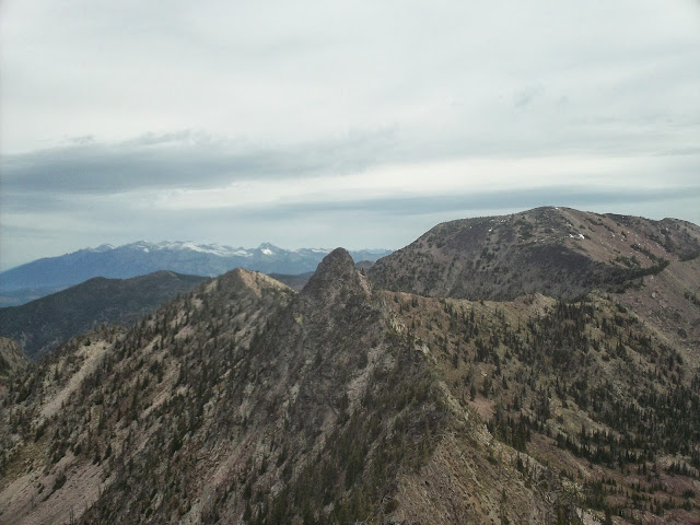
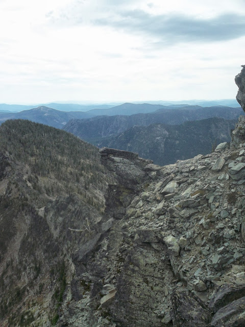
Beyond Murphy, the ridge started to get spicy.  Eventually, I had to downclimb some loose class 3 to get around some gendarmes on the ridge.  This was some pretty chossy and sharp shale type junk, and the scree was too thin to ski, and the holds were all negative, so the going was sort of slow.  I hit a small col above Finley Lakes here, and then had to climb at the 4th class level some pretty solid pink quartzite to regain the ridge.  The climbing here was fun and rather exposed, but slow once again.  Things mellowed out here, and a few miles of straightforward ridge running and sidehilling finally brought me to the crux of the route, and the section that turned me back, two unnamed high points that look rather like bunny ears when viewed from Mosquito Peak.  The western ear is easily surmountable, with a nice talus gully leading up and over.  The ridge between the two was also plausible though exposed.  The eastern ear was highly exposed, wet (snowy on the N. sides!), and looked to be upper 4th, perhaps 5th class on loose rock, and more than I wanted to deal with solo and so far in the backcountry. 

I made a tentative effort to downclimb into the basin to the S., but ended up getting cliffed out.  4h30m into the day, with weather looking like it might deteriorate and plenty of scrambling left to do, I opted to turn around.  The scrambling on the way back went slowly again, and routefinding through the 4th class bit was trickier than going the other way.  I ended up back at Point Six at the 7h30m mark, and I took the Beargrass Highway back down, which is tremendously fun and fast running, and made it back to the truck around the 8 hour mark. 

I'm going to have to successfully summit now.  I've got a strong idea how to do it more easily now, mainly by bypassing most of the trickiness.  The ridge run is elegant and fun, but also slow, and the traverse to Sanders Lake across upper Grant Creek, despite the lack of trail, seems like it would be straightforward (I know it is during the winter).  From Sanders, I intend to contour around the ridge that extends south from the west rabbit ear, and from there, it's a simple matter to regain the ridge and climb it to McLeod.  Now just waiting for the weather window and the time.  Total distance for the day was 19 miles with 8000' vertical.  The complete route would be more like 23 miles with 10000'.

Snowy Missions from Murphy Peak.
The East Rabbit ear from the west, looking difficult.

Klapperslange Tungen.

The way home.


Monday, September 16, 2013

The Rut 50k

On Saturday, I ran the Rut 50k in 6:05:43, which was enough for 8th place.  I had a really good time on this beautiful and difficult course, and I learned a great deal about how to train to do better next time and what some of my stronger and weaker skill sets are.  This being my first race ever (not just ultras; this was the first footrace of my life), I couldn't (reasonably) be any happier.  It happened like this.

Molly and I, having camped up Swan Creek, a big trib of the Gallatin, woke up at 4:45 to a solid drizzle, and I made a quick breakfast of 4 slices of bacon, some delicious Quebecois full strength yogurt (Liberte Brand), and a healthy scoop of nut butter.  We made the short drive up to the Big Sky base area, and picked up a bag of decent quality schweg as well as my race number, which was 23.  We sat around in the nice lodge, and I drank too much tea.  Mike the RD announced that lightning considerations were sufficiently tolerable to keep the climb up to Lone Peak as part of the course (there had been some doubt in the previous days.

Two minutes before the race start, people were still milling around, with a few people tentatively drifting towards the inflatable starting arch.  I felt presumptuous for doing it, but there was nobody really lined up at the front yet, so that's where I positioned myself (I gather that the front is usually where people who think they're going to win stand).  When the race started, I got excited and went out with the front runners, Pocatello's Luke Nelson setting the pace.  I even managed to stay with them for most of the first 1400' climb, but then I got dropped when we topped out on a flat road.  This section was pretty short, and then the race dropped down some steepish, pretty rocky single track that was a blast.  I made up a bit of time here, getting some of the leaders in view again, but they dropped me again when the course flattened out onto a vaguely downhill access road threading through some Moonlight Basin vacation properties. 

I was in eight-ish around this point and I didn't see anyone else for another six miles, well after the first aid station (which I didn't stop at because I had plenty of food and water).  Sometime around Mile 11, the eventual winner, Paul Hamilton, caught up with me and loped past effortlessly.  At the time, I thought that I had slowed down, but it turns out that he was just moving really fast.  I managed to maintain my position all the way to the next aid station, even passing someone on a short stretch of rocky downhill, although Brian Story and two others were creeping up on me and we ended up all reaching the Lone Peak tram dock around the same time.

I again made up a bunch of time running back downhill to the base of Bonecrusher ridge.  I had recognized at this point that I was generally slower on the flats and climbs than my pursuers, but notably faster on the descents.  I decided that leveraging this on the descent off of Lone Peak was probably wiser than blowing up trying to move too quickly to the summit, and maintained a pretty relaxed hiking pace to the top.  I was feeling it in my legs from the long, moderate switchbacking climb up to the tram dock, and in my lungs from the altitude (I never do any sustained running above 9000' while training in Missoula).  I got passed three times on the 2100' ascent to Lone Peak, but I made it to the summit within a minute of all of those that had passed me.  By the way, the ascent of Bonecrusher ridge must be one of the gnarlier sections of trail to be found in an American trail race, not that I have a basis for comparison.  It hits 40+ degrees towards the summit, with loose rock and good exposure off the right-hand side.  The wind was blowing, and the cloud deck made me feel like I was mountain climbing rather than racing. 

At the summit aid station, I learned that I was 30 minutes or so behind the front of the pack.  Obviously no chance of making that up with 12 miles to go, but it felt nice to hear that we weren't getting completely smoked.  I drank some Coca-Cola and started down the rocky, technical southeast ridge.  I consciously pushed hard down the ridge, taking some risks on the loose and wet rock (interesting geology through this section by the way).  I passed four people during the descent, and got a bunch of rocks in my shoes from scree-skiing down a little gully.  By the time I hit some flatter terrain towards the bottom, I had put at least 2 or 3 minutes on my nearest pursuer, time that I knew I would need to maintain my position if patterns from earlier in the day held. 

I reached the base of some lift (Swiftcurrent?) and a guy there told me that it was mostly jeep tracks to the finish.  This was not strictly true, but there were jeep tracks for a while.  I kept catching glimpses of Jeff Rome in front of me (and would for the remainder of the race), but was never able to make up any time on him.  Not much happened for the next five miles.  Some moderately ascending  roads gave way to some moderately descending single-track.  The ascent of Andesite Mountain to the last aid station was easy and fast, with the exception of the ascent of the Africa mountain bike trail, which included sections of clawing up near vertical mud walls.  I don't know how a person rides down it.  Someone had almost caught up with me before this bit, but I managed to put up a bit more of a lead through here and hit the final aid station with a reasonably comfortable pad.  The volunteers at all of the aid stations were wonderful, but these ones had been so nice as to learn my name, which was a surprising boost (to my ego, I guess).  Thanks guys.

I nearly sprinted out of the aid before realizing that doing so was laughably non-sustainable at that point, even on a downhill grade.  I still tried to push the steep single track as much as my legs would allow, but these last five miles were the least interesting of the race and I just tried to keep from slowing down.  I powerhiked a final climb, ran some rollers, and then had a mellow descent to the finish, where Molly and Louie were waiting.  I had suspected that I was in eighth for a while, but this was confirmed at the finish.

A few thoughts (about improving my own performance, probably not of much interest to anyone else):
1.  My training, especially the last month, wasn't really done properly.  I've been spending a great deal of time powerwalking ascents or hauling ass down technical stuff.  Both of these things helped (especially the technical descending), but most of the race was still just trail running.  I'm a relatively slow runner, and I don't climb (while running) all that well.  I need to do more straight trail running (and flatland speed training) to be competitive in these kinds of events.

2.  Cross-training is something I need to do, especially cycling.  I need more sustained time at VO2max.

3.  I was forced into a pretty long (2 week) rest period by various obligations before this race.  I called it a taper.  This was way too long, and I got stiff during that time.  This may or may not have hurt my performance, but is definitely increasing my recovery time.  Four or five days of tapering will probably be sufficient.

4.  Also on recovery, I had been a little lax in allowing grains back into my theretofore mostly grain free diet.  Again, may or may not have been detrimental to race performance, but almost certainly increasing recovery time.  Eating fewer gels is also appealing. 

5.  No caffeine within an hour of starting.


Monday, September 2, 2013


This was my final week before beginning to taper for the Rut.  I covered 67 miles and logged 25200' of climbing, much of which was high quality training (either high intensity, in difficult terrain, and/or in 90 degree heat.  Or I was hiking in a fairly relaxed way).  Really felt like I got something out of this set of runs, and I'm feeling very prepared (and stoked!) for the race. 

About that race...  I digitized the course for the Rut in Google Earth, essentially by tracing the existing Google Maps route that exists on its website, and extracted the elevation profile.  The distance is pretty close to the reported 50k.  The vertical reported by Google Earth, however, is just shy of 12000'.  Note that this is almost 4000' more than is reported.  I think that Google Earth elevation profiles often inflate vertical gain due to high-frequency trail undulations and errors in the GE DEM.  To counter this, I just measured from obvious low points to obvious high points and summed all of the climbs that had a vertical above 500' or so.  I got more or less the same result.  I can't say that I really mind.  I like vertical, and my training has tended towards more vertical and lower miles, because that's the kind of terrain that I find compelling.  I just hope that nobody gets sandbagged by an extra 50% of climbing (and descending) on top of an already significant figure. 

I'm also looking forward to a trip down the Main Salmon this coming weekend, with Molly, Louie, many friends, and (significantly) my brother, who's flying in from the East for his first river trip through the Idaho wilderness.   


08.26.13 Sentinel Hill Climb, 3mi, 2000', 41min:
25:30 up (PR), few minutes on top, about 13:00 down.  Done at around 1PM

08.27.13 Sentinel Hill Climb + University, 8mi, 3700', 1h30m:
26:45 up, then tagged the summit if University Mountain at 54:low.  Done at 4PM.

08.28.13 Sentinel Hill Climb + University, 14mi, 4800', 2h10m:
27 up, but then a much faster trip over to University, hitting the summit at 51:03 before running over to the South Side trails and running the fun singletrack of the Sam Braxton trail.  Started at 4:30.

08.29.13 Sentinel S + N, 6 mi, 1900', 52m:
Short evening run with Louie.  Finally cool enough for him to hang outside the early morning hours.

08.31.13 Williams Range Peaks, 9800' (+400'), 25mi (+3mi), 7h30m (+1h):
Finally managed to visit the rugged Williams Range, in the heart of the (proposed) Great Burn Wilderness.  Access for me was 12 miles off the northwest side of Lolo Pass.  I've been wanting to visit this region for a while, having seen its craggy peaks from both the south and north, as well as fished Cayuse Creek, Kelly Creek, Crooked Fork, and the Lochsa, which all have their origins in this knot of not especially high, but remarkably pristine and beautiful peaks in a corner of Idaho that sees very little traffic. 

I left the truck at 7:30, running through an open old Lodgepole grove that shared a glacial valley with the upper Crooked Fork.  After a few miles, the trail started climbing steeply up the east wall of the valley, and I quickly reached a saddle below Granite Peak (7551'), my first objective for the day.  This saddle was also the end of regular trail maintenance.  Granite Peak is about 2500' and 4 miles from the trailhead, and I reached its summit about an hour.  Climbing the solid rock pinnacles that give the peak its name was great fun and afforded excellent views of the route for the day, which would include both Shale Mountain (7612') to the north, and Rhodes Peak (7930', highest of the range) to the west. 

I followed the ridge from Granite to an unnamed high point, with intermittent aid from a very old and very underutilized horse track, and from there headed north to Shale, losing and regaining a lot of elevation in the process.  The ridgelines were mostly bare, due to the fire that sterilized the soil in 1910, and from which the vegetation has not yet recovered.  The lack of vegetation also allowed a great deal of erosion to occur, and the ridges were sometimes composed of almost beach-like sand, and sometimes of bunchgrasses.  Hoodoos of resistant granite protruded haphazardly, but didn't present the same kind of obstacles that ridgetop outcrops do in the Bitterroot Mountains.  I was back to the highpoint connecting Shale and Rhodes just before the 4 hour mark, and made a conscious effort to push hard to Rhodes, finding a decent section of trail for a little ways.  The trail once again petered out though, and I ended up taking a fairly inefficient to the south ridge of Rhodes, and from there the summit.  Below Rhodes, I found the only (only!) water of the day (except at the very beginning), a little spring of tepid water in the hanging valley east of Rhodes Peak.  It was low quality water, but a joy nonetheless, having been dry for almost two hours.  Now that I knew the routes, I ran the 10 or so miles back to Granite Peak relatively quickly, and from there, the descent down the open pine forests and good trail was a gas.

I reached the truck in good spirits (from eating enough sugar during the day) and time to spare to reach Lolo Pass, where I was to meet Molly to go camping.  We ended up visiting the Elk Summit area, taking a good hike that evening out to an overlook from which views of the West Fork of Moose Creek and its mountains were visible.      


09.01.13 Friday Pass, 2600', 8mi, 5h:
Great hike from the Kooskooskia Meadows trailhead, near Elk Summit.  Pretty lakes (but no fish), and awesome views of the Roots and Graves Peak.  

Granite Peak summit.

Hoodoo with Rhodes Peak.

Shale Mountain summit.

Rhodes Peak summit view, with Ranger Peak in the distance.

Ain't nothing says America like a Mule hitched to a flagpole.

A pleasingly symmetric Graves Peak.

Making waves in Swamp Lake.