Sunday, June 1, 2014

Scapegoats.

Sometimes, I find, a visit to a good, old fashioned blank spot on the map is in order.  Public and private beta is indispensable, but structured route information (like guidebooks and blogs) often turns into a checklist and can stifle creativity when it comes to selecting a route.  Alternatively, new areas are a shot in the dark, and can often be disappointing at best, heinously uncomfortable at worst.  Thus, a reliance on beta is probably one's best bet when it comes to consistent and high quality skiing (or whatever), but by definition, you're not going to be doing anything new.  Having gone after local classics for much of the spring, Casey Wilcox and I set out to explore a piece of Terra Incognita, at least as far as skiing goes.

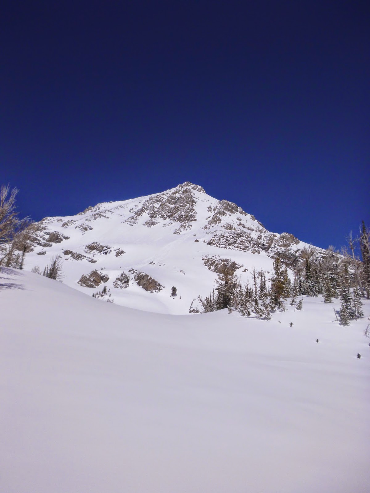
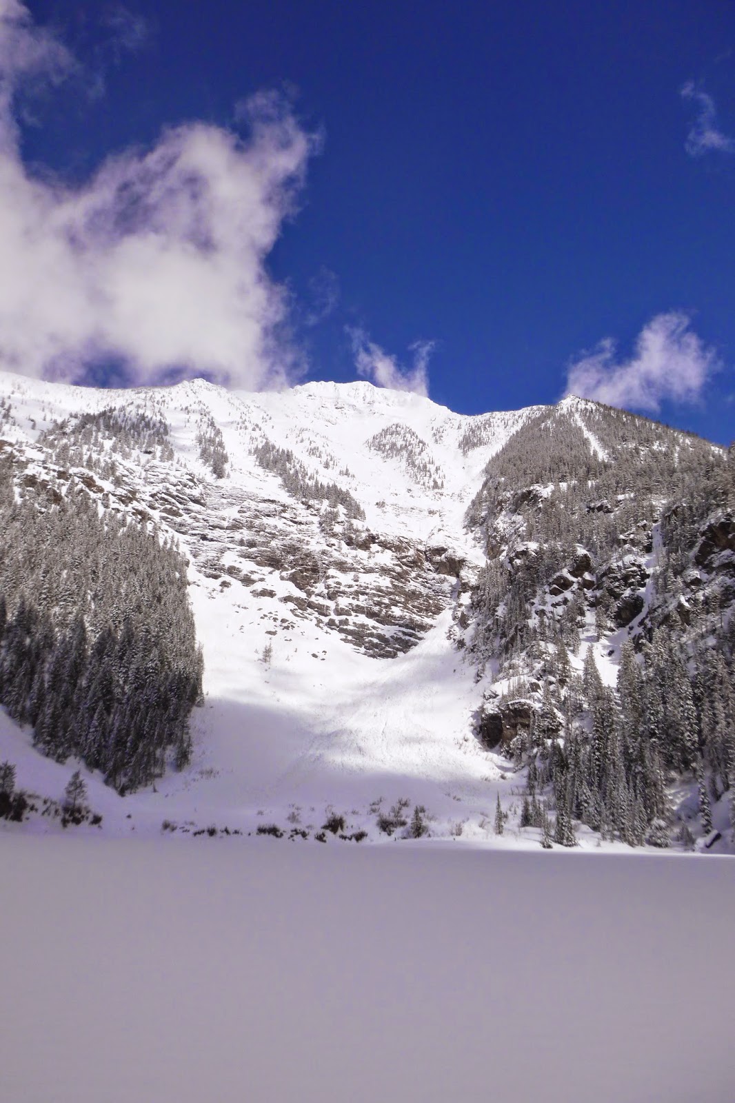
Red Mountain, at 9414', is the highest point in the Bob Marshall Complex (higher than the Swan, higher than the front).  It is, however, distinctly more subtle than its slightly lower and better known competitor, Holland Peak; it is not obvious from any highway, and it's a bit further from Missoula.  Access is via the Lander's Fork of the Blackfoot, up a decent dirt road that is drifted over until late in the season.  The terrain is relatively rounded compared to the glacier sculpted rock-and-ice massifs of the Swan or the Rocky Mountain Front, and the country is dry, cold, and mostly burnt from the Canyon Creek Fire, which devastated the Scapegoat 25 years ago.  There aren't many lakes.  It doesn't snow there much compared to the western and northern parts of the Bob, and the westerlies whipping towards the nearby continental quickly blow bare all the ridges and west aspects, leaving the blonde shales and eponymous red quartzites and slates exposed everywhere but the sheltered north and east aspects.  Nobody ever called Red Mountain a crown jewel.

Red Mountain is remote, and sees very little traffic.  As such, it is a playground for grizzlies, who root for tubers on the hillsides; their tracks are abundant and ubiquitous.  Goats also live on the highest reaches of the peak, where the lack of snow makes for easy foraging on the lichens and abundant alpine Forget-Me-Nots, for which this part of the Scapegoat is known.  The skiing is very good.

We left Missoula at 4:45, driving eastward, and keeping pace with cloudy skies and a rapidly departing cold front.  After an hour or so, we turned up the Lander's Fork, and then Copper Creek, where we got our first glimpse of a large couloir off of a subsidiary peak to our objective.  There was a lot of snow in the valley.  There wasn't very much snow on Red Mountain.

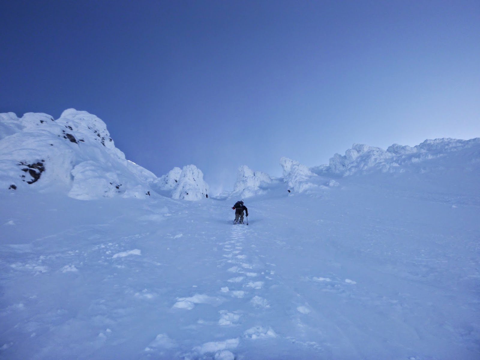
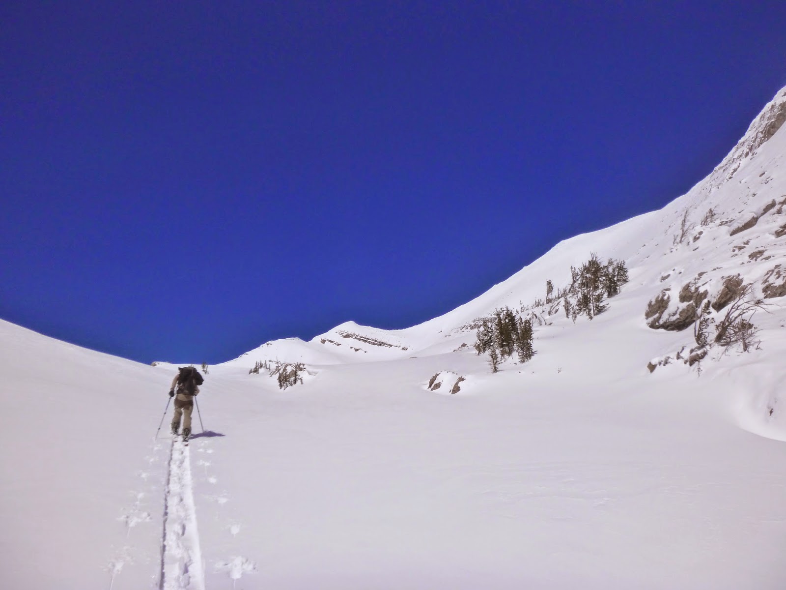
After rallying the Toyota over some robustly refrozen drifts, we decided it was probably wise to position the truck such that we would be on the highway side of these when the drifts became not frozen.  Thus, more rallying.  The walk up the road was only a few hundred yards, and then easy walking up a burn covered with corn.  We reached a low point in the ridge above the Copper Camp Snotel quickly.  A strong and icy wind was present at the ridgeline, and we spent a few minutes huddled in council about which direction we were supposed to go and donning layers.  After a false start, we made the right choice, and proceeded northward.

We walked the ridge for a few miles, admiring the flowers, getting blasted by icy wind, and crossing deeply sunken grizzly tracks left by a very large bear on a much warmer day.  The ridge walking was easy (with the exception of a short third class step) and pleasant, and the bowls on leeward aspects were well filled in, though absolutely bulletproof.  The ridge ascends and descends two sub-peaks before reaching the summit of Red Mountain.

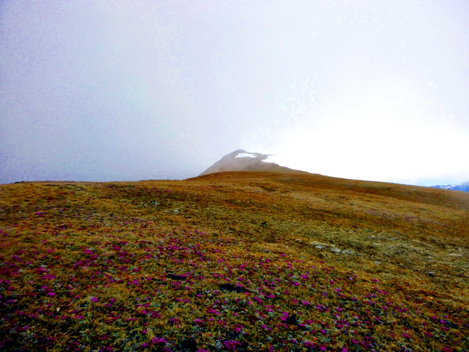
Alpine Forget-Me-Not on the ridge below Red Mountain.

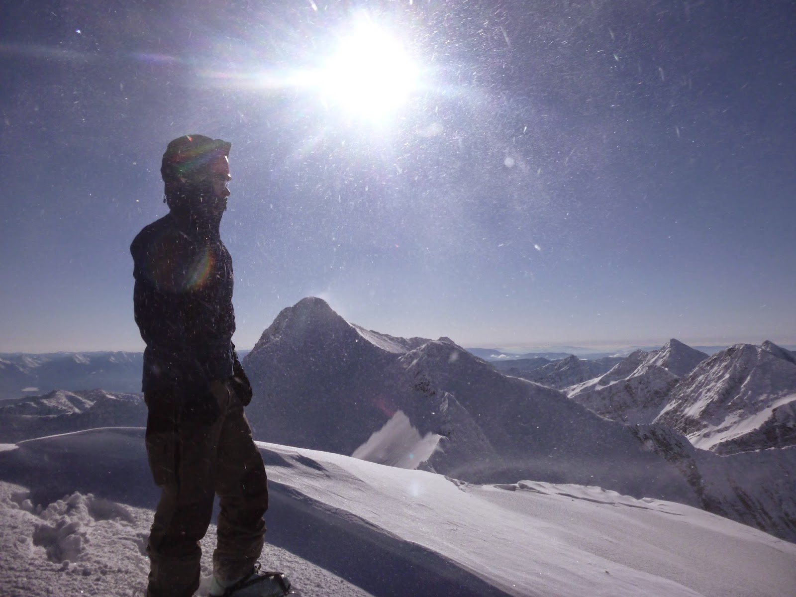
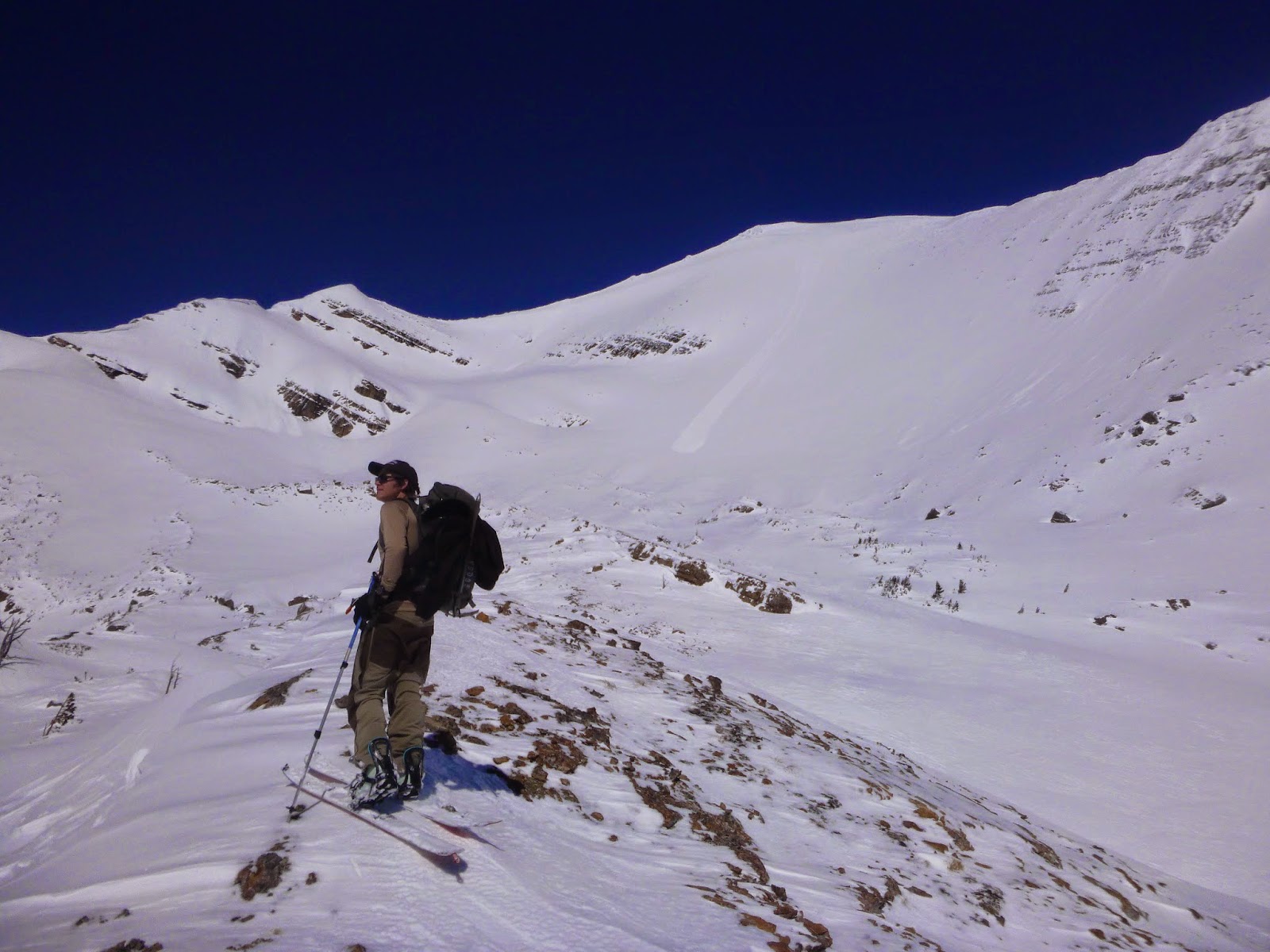
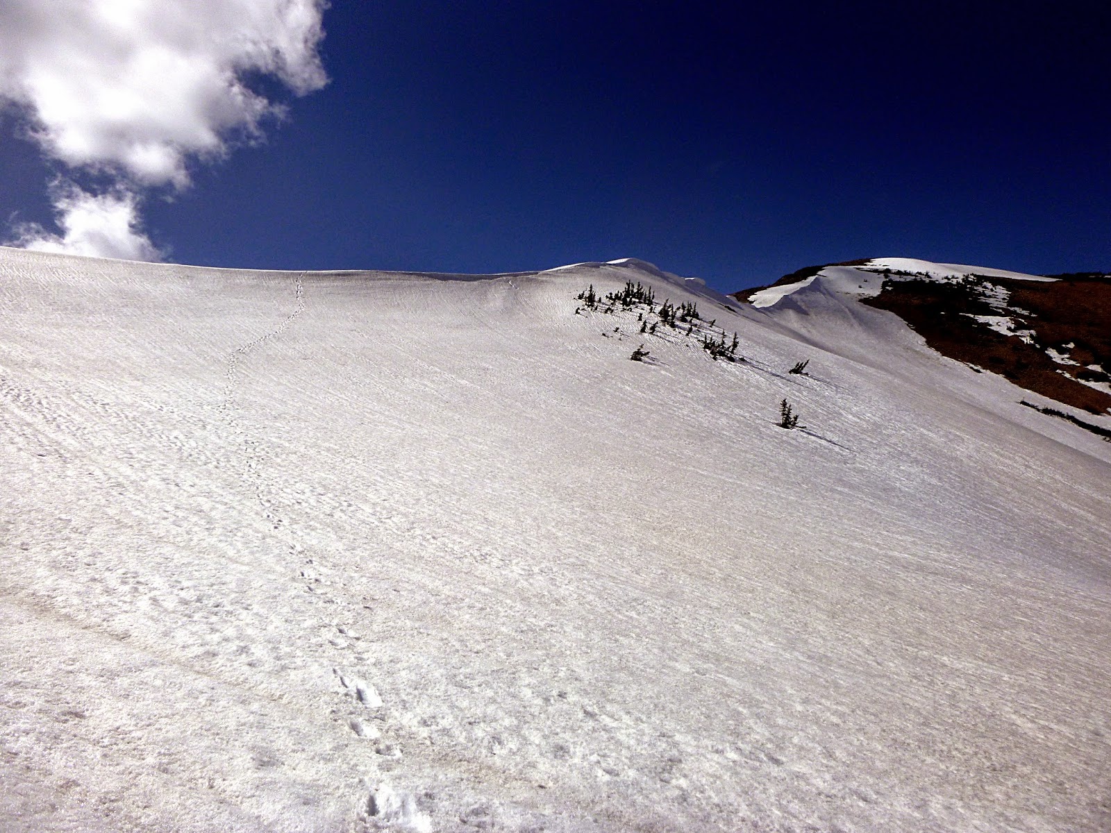
By the time we summited, some of the cloud banks were beginning to clear, and the wind becoming less icy.  I investigated a pair of long couloirs on the western side of the peak that I had hoped to ski.  They were snow free, and so we opted against skiing them, settling instead on the 1800' northeast face.  Snow conditions on the ridgetop were still dishearteningly hard, and some waiting seemed like a good idea.  We are both, however, terribly impatient with this kind of thing, and I dropped over the steep cornice.  To my surprise, I found firm but suitably edgeable corn, which steadily improved as I descended this steep and open face.  Despite expectations.  We were bolstered by the unexpected snow quality, and quickly transitioned to crampons for the climb up to Red Mountain's east ridge.

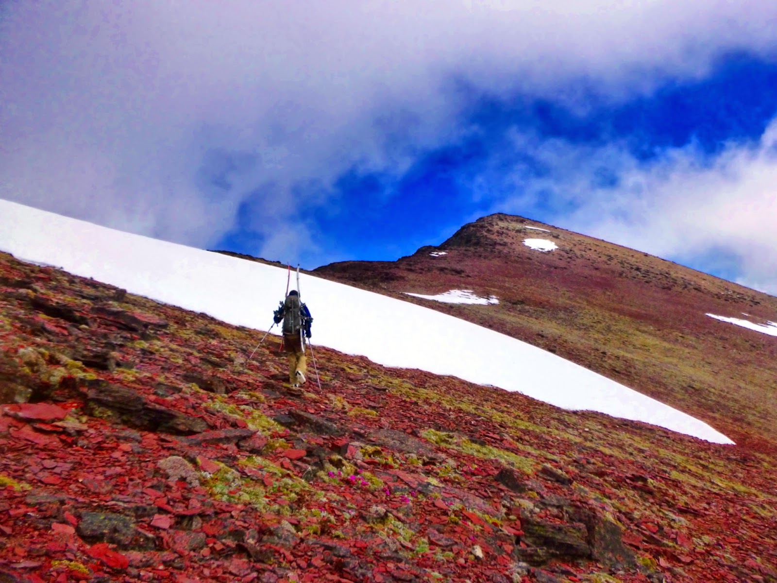
Approaching the summit of the appropriately named peak.
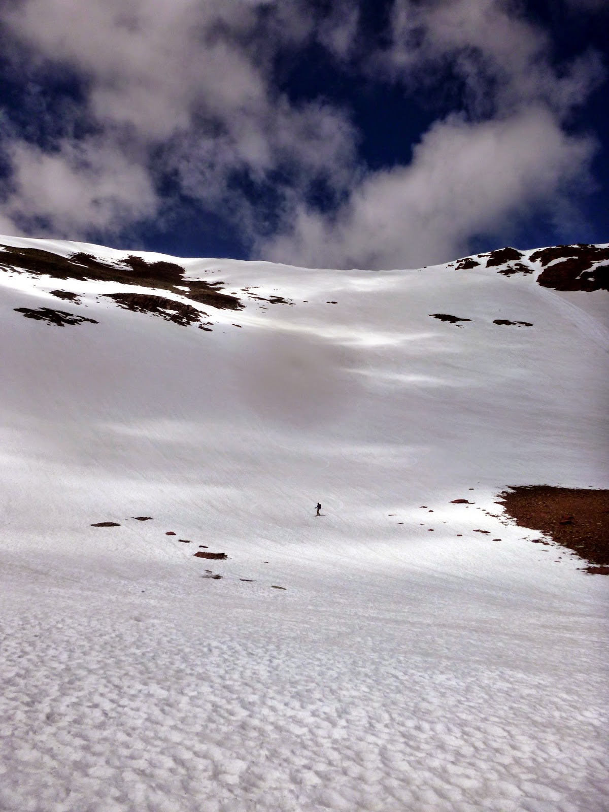
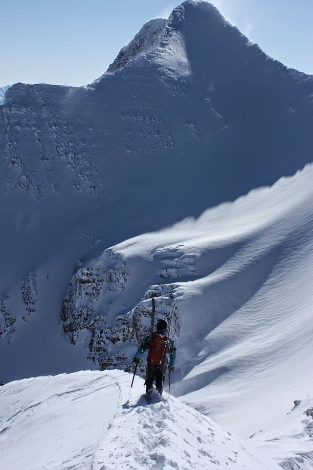
Northeast face of Red Mountain.

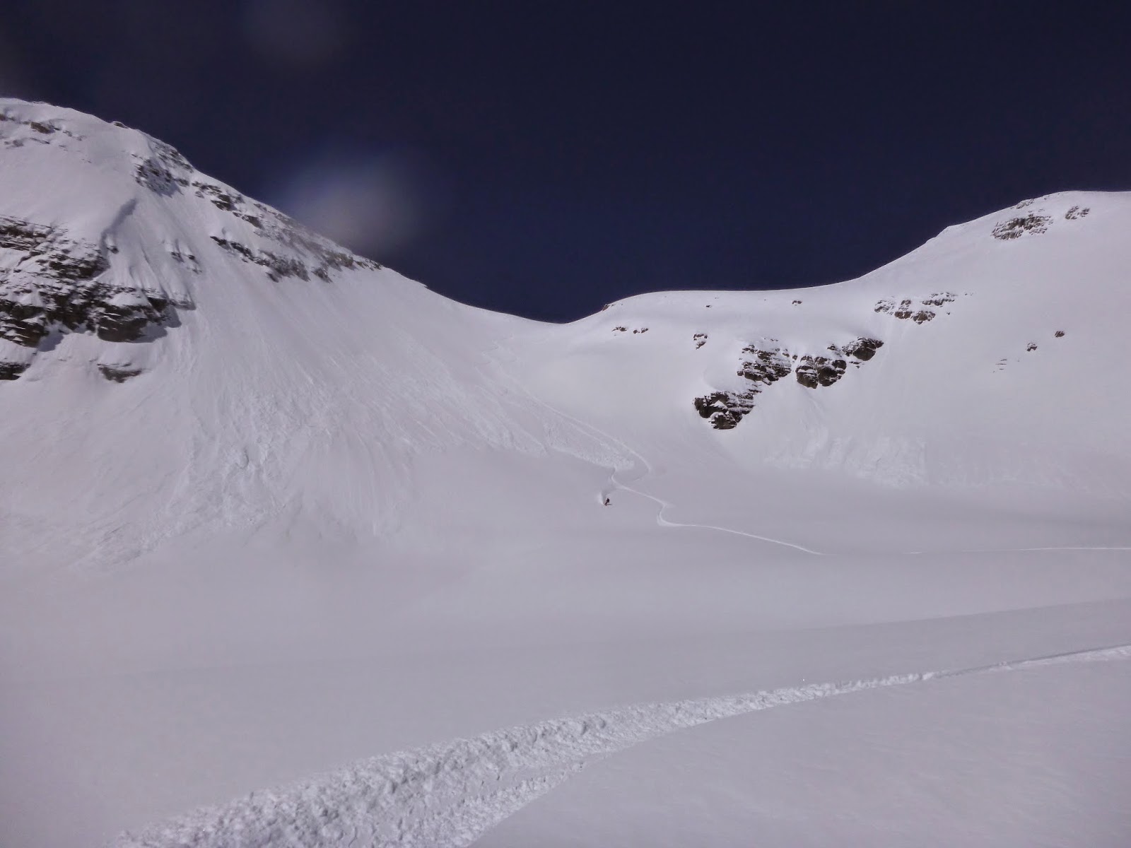
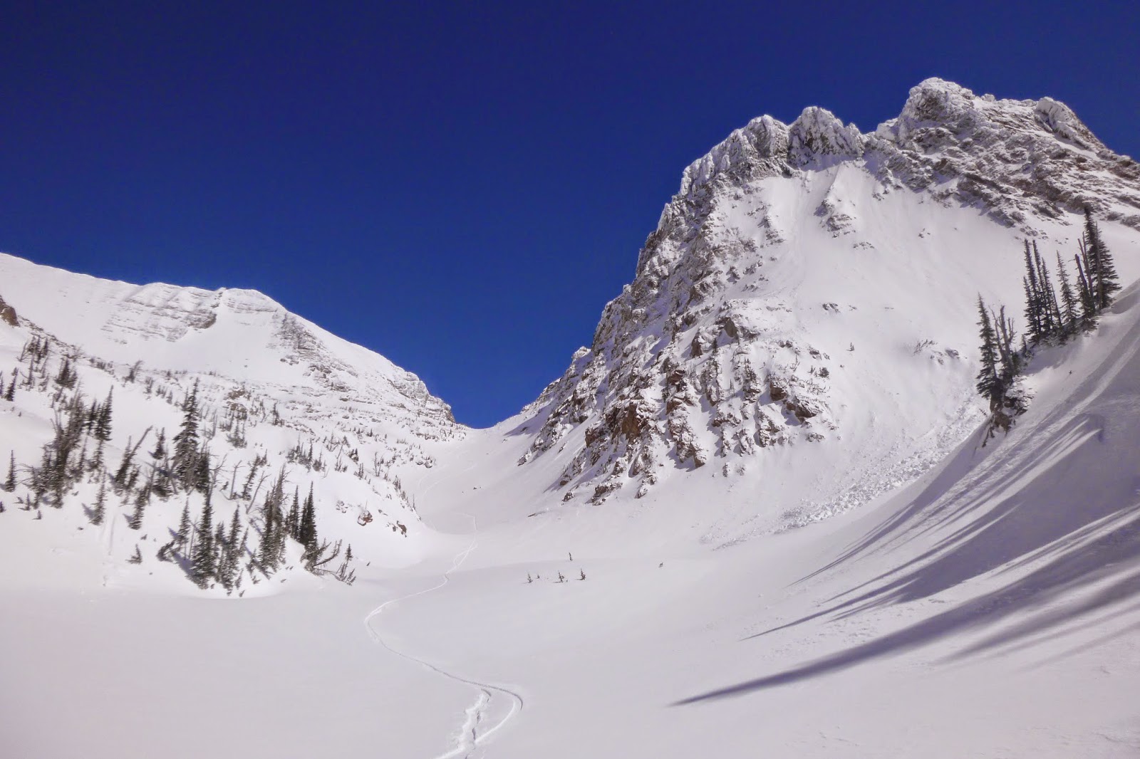
It was apparent that conditions were game-on; the refreeze the night before, the countless freeze/thaw cycles, and the low high for the day meant that just about anything was suitable for safe skiing.  As we climbed back up towards Red Mountain, we saw that the next sub-peak to the south (Blonde Mountain?) held another vast northeast face, that rolled from a mellow face onto a big and exposed affair bisected by cliffs, that looked superb.  We quickly walked to the top of the face and dropped in.  The top of the roll-over was spooky and confusing, but Casey quickly found the appropriate chute descending through the cliffs, and we regrouped at a tarn at the bottom of the face.

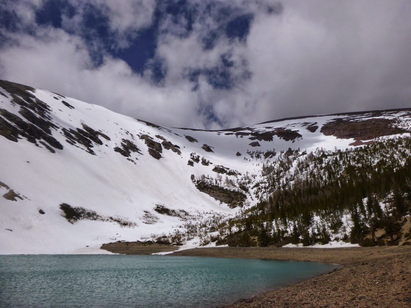
Run number two was through the cliffs on the left side of the photo.
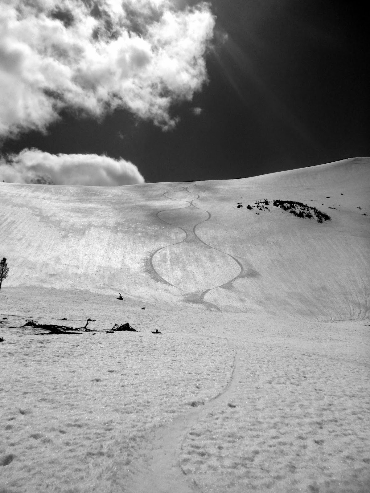
We didn't have much of a plan from this point, but were quite enthused by the previous run.  As such, we decided to bowl bounce the remainder of the return to the truck.  We reascended the east ridge of Blonde Mountain, and in so doing spied an extremely compelling couloir with at least 1000' of vertical and rock walls dropping from near the ridge, into the basin.  We traversed above cliffs to the entrance of the couloir, where the wind scoured and low angle ridgeline abruptly gave way to cliffs, with this highly aesthetic couloir threading perfectly between.  The couloir was very similar in steepness and character to Greywolf's south couloir, but a bit longer.

Axial Symmetry.

From the bottom of this couloir, we ascended sub-ridges and skied two more bowls and one more short, steep, and spectacular couloir before finally attaining the last ridge whose south face would deliver us back to our vehicle.  The snow had gotten progressively softer at lower elevations and the return to the rig was an enjoyable cruise through an old burn and over snow-bridged creek bottoms full of meltwater.  No bushwhacking, plenty of bear tracks, and we were able to ski to within a few hundred yards of my truck.

Bear tracks.
For the day, we skied right around 10000' of vertical, and done in 11 hours car to car.  I would highly recommend exploring this zone to anyone wishing to explore a beautiful and unique area far from the beaten path.  I am also curious if anyone has skied these lines before and if anything has been named.  If you know, let me know.

As a Scapegoat bonus, on Saturday evening Helena joined Molly and I for Molly's last long run before the Pengelly Double Dip.  We ran to North Fork Falls on the North Fork of the Blackfoot, a round trip of 14 miles.  The falls are formed by a young anticline composed of the same layers that form the summit of Red Mountain pushing up through the softer surroundings.  It's an imposing place during spring runoff, as this pretty big river drops four-hundred feet over half a mile. 

The North Fork of the Blackfoot just below the main pitch of North Fork Falls.


Tuesday, May 27, 2014

Harvest Time.


The Garden Wall and its central couloir above Picture Lake on the way to Mountaineer Peak.

Lo, and in the fifth month,
Ullr looked down upon his sycophants,
and saw that they wept.

Glide avalanche remnants accumulate below the Garden Wall.

O, sunburnt children, why do you despair?, he asked.

Point 8893, Glacier Peaks, and McDonald Peak from Mountaineer Peak.

With gnashing of teeth they replied:
Ullr, the Death Star hath stolen thy power,
and turned powder to potatoes,
and wetted our skins.

Mickey Smith near the summit of Point 9066, on the ridge south of Mountaineer Peak.
 
Mickey skis the perfect corn.
 Ullr saw that they spoke truth, and was saddened,
and resolved that he would grant them an artifice of
power to absolve them of their woes.

Casey Wilcox walks across a frozen lake high in the headwaters of Mission Creek's north fork, after a descent of the east face of Point 8893.  Wet slide conditions and poor visibility mandated that we turn around 150' before the summit.

The Sonielem Ridge in clouds looms above Lucifer Lake.

The west face of North Glacier Peak from near the Mission-Ashley Creek divide.

Children, said Ullr, take these golden gears and wind them surely.
Set them to chime at 4 and 30, so that you wake before the sun shall rise,
and make haste to those realms of mine own that remain
a hundred chains above the sea or better.  And then be patient,
and wait for the anointed time; not too hard, nor too soft.
And then shall you partake in the harvest of Corn, and the Corn
shall not harvest you.


Looking at rocks is a nice part of springtime.  Mission-Ashley Creek divide.

The 4400' southwest face of the Sheepshead above upper Ashley Lake.
  The sycophants flocked to the hills and skied steeply,
clad in naught but tunic and codpiece.

Lolo Peak, north summit viewed from the south summit.  The Heavenly Twins are visible in every Bitterroot summit photo.
 
Albedo matters.  Carlton Lake.
 And Ullr perched amongst his lofty peaks smiled,
for he saw that it was good. 

Mormon Peak Road is getting alot of traffic these days.


Tuesday, May 13, 2014

Spingtime for Jumbo and Sentinel, wintertime for Chaffin and (snow)pants.

The last few weeks have been somewhat awkward for the mountains of western Montana; the snowpack and the weather just hasn't been able to make up it's mind about whether it's spring or winter.  Significant snow accumulations and cool temperatures above 6000' have been alternating with short lived bouts of unseasonably warm sunny days, producing some generally funny travel and avalanche conditions.  Thus, I hadn't a successful tour in a few weeks until yesterday, instead exchanging touring for getting my running legs back under me.  The local hills are blooming with the May wildflowers, with the early ones like Shooting Star and Fringecup now yielding to the ubiquitous Arrowleaf Balsamroot and Lupine (and the lovely Dalmatian Toadflax...  a noxious name for a noxious weed).  Nonetheless, with a hard freeze predicted for Sunday night, I sacrificed my weekend to work in order that I might take advantage of the fresh snow, refrozen stability, and bluebird conditions for an attempt on a southern Bitterroot classic, Sugarloaf Peak's north couloir(s).

Casey, Chris, and I met at the Pattee Creek Market parking lot at 4:30 for the longish drive to Chaffin Creek at the end of the Bitterroot, during which I solicited Casey's opinion on whether swimming the Middle Fork of the Flathead in drysuit and PFD would be preferable to lugging a packraft and paddle for this one river crossing during the upcoming Bob Marshall Wilderness Open, in which I intend to participate.  I'm thinking of using the drysuit with puffy layers underneath as a bivy system (with the PFD as part of the pad).  This weighs about as much as a packraft setup and seems more useful, particularly given that there are no other opportunities to use the packraft on my chosen route.  What difficult problems we face here in America.  I still haven't decided.

Chaffin Creek turned out to be closer than anticipated, only a bit over an hour, and we were hiking at first light, anxious to make the 5-6 mile approach quickly.  The hike was standard, but Chaffin is extraordinary amongst Bitterroot canyons.  Good skinning starts around 6000' right now, and we made it to the base of Sugarloaf in a bit under 3 hours, including a creek crossing.   
 
Sugarloaf north aspect.  The couloir that accesses the upper face is the sliver on lookers right at the top of the apron.

We made quick work steep skinning the apron to the base of Sugarloaf's north couloir.  There was a surprise abundance of fresh, dry, and settled powder.  When the going got steep and narrow, we switched to crampons, and securely ascended the 40 degree couloir.  I'd been here once before, but was once again enamored with this steep granite defile.  The walls are shear and it feels like being in some desert slot canyon (with some obvious differences).
Apron skinning.

In the couloir.
The last pitch to access the upper face was steep and icy, and I was glad to have crampons and axe, which allowed us to quad-point this bit easily.  The cornices overhanging the couloir made me glad that we had gotten an early start on this warm day.  The north face, like many such faces in the Bitterroot, is exposed to transversely oriented westerlies that tend to strip the face down to talus or shallow and slabby snow.  As such, we left the planks at the top of the couloir and walked towards the summit, keenly aware of the exposure on this hanging face, which is just steep enough to command attention.  The final pitch to the rocky true summit was more than I felt inclined to tackle, but Casey and Chris made the trip, which was a good photo opportunity for me.  
 
The summit of Sugarloaf Peak.

The south face of the Shard (left) and Tin Cup Peak (right).  The south face of the Shard is as epic as anything I've seen in the Bitterroots, and seems as though it would be a ski mountaineering objective on par with the east faces of El Cap or Sky Pilot.
With the summit bid complete, we skied back down the couloir in good style and major sluff.  The fresh snow, though not slabby, was deep and inclined to move.  It was fun managing these big streams of snow atop a bomber snow pack lower in the column. 

At the bottom of the couloir, we concluded that another run was in order, and we booted another somewhat hidden couloir further to the east on Sugarloaf's craggy north face.  This route steepens to 45 or more degrees before pinching into an alpine climbing affair that may very well offer an alternative and challenging route to attain Sugarloaf's summit.  We stopped where the skiing did, and skied this thousand foot line back to the apron, again producing vigorous and entertaining sluffs.
 

Dropping (with Furberg cameo).
Sluff management in Sugarloaf's hidden couloir.
The day had turned warm so we pointed skis towards home.  The apron back to the creek served up another thousand or so of good quality chalk (though riddled with wet slide ice bombs) back to the Chaffin creek-bottom, where we refilled water and refuelled for the hot and soggy egress.  14 miles and 6000', done in 11 hours car to car.
 
Both couloirs visible.


Sunday, April 27, 2014

Half Daze of Glory.

Sometimes, you might imagine that you don't have enough time to go skiing.  'I have to go to work because I already used up all my vacation time going to Moab,' you might say, and this may in fact be true.  But couldn't you find the time for a little half day of skiing?  Yes, you will have to wake up early, and probably drive too fast on dirt roads.  It's fine.  It's worth it.

Murphy Peak - South Face, 5000', 7h.
With friend Perry in town, I was not able to withstand the draw of a day of skiing in the Snowbowl backcountry, especially with the ski resort now closed.  We met at 6 at the last pullout, and started skinning up Paradise (legally of course).  This went quickly as always, and we were soon skiing across Burgundy Ridge, then ascending the south ridge of Murphy Peak.  We acquired the summit at 8:30.  This was good, because the hot sun was already starting to generate point releases on the cliff bands, and the proper runs off of Murphy were very likely next.

Getting weird, early AM, Murphy summit.


After some summit headstands with the Missions providing a suitable backdrop, we skied the south face of Murphy, in good conditions, with the exception of icy point release remnants towards the bottom.  A quick schuss had us at the top of Jenny Bowl, which was terrible, then to the top of the Hourglass Chute in the closed cliff area at Snowbowl.  It's unfortunate that it's closed, because it's the best in-bounds run around.  Back at the car at 1, back at the office at 1:30.  Half Day!     

Greywolf South Couloir. 5000', 6h.
With friends in town once again and myself obliged to drive to Idaho that evening, we opted once again for the half day tour.  Greywolf's south couloir is perfect for such a venture, especially now that P-5000 has melted out, meaning that you can drive there directly from Arlee, skipping the lengthy diversion through St. Ignatius necessary earlier in the year.  Casey, myself, and Mr. Burger left Missoula at six, and were skinning by 7:30 (we didn't yet know the shortcut was snow-free).  We were quite thankful for the climber's trail, and it's in good enough shape right now that utilizing it saves alot of time. 

We made reasonably quick work of the approach to the Grizzly Lake basin, though we took a fairly inefficient high route trying to avoid exposure to the avalanche prone sidehill immediately before attaining the upper basin.  As soon as we started skinning across Grizzly Lake, it was apparent that new snow had formed a deep-ish wind slab that would have to be monitored closely as we ascended towards the south couloir. 


While the apron was a little spooky, once we skinned into the more protected couloir, we were happy to find that the wind slab had dissipated into settled powder (though still a bit punchy in spots).  We skinned to the obvious safe zone, then transitioned to booting.  The snow was deep and the walking tough, yet we had only a few hundred feet to go, and were soon climbing through the magnificent cornices guarding the divide between the south couloir and Grey Wolf's craggy western aspect.    
 
The top of the south.
I hate going first on steep runs, because I'm not very brave.  But with Casey taking photos, and Burger insistent that it was improper for him to precede me, I was left with no alternatives.  It was great fortune to find the south couloir in good condition in April, and the steep turns off the headwall were fantastic.  In fact, the skiing all the way back to Grizzly Lake, 1500' below was of good quality, excluding the occasional point release ice chunk bomb lurking here and there.   
 
Burgermeister ripping full tele turns down the south couloir. 

Wilcox on the mellow apron above Grizzly Lake.

Lakefront reminiscence.
 The ski down through the forest was uneventful (as ever), through good corn at the top, and catchy slop at the bottom.  We barely got lost, and made it back to the rig by 2.  Beta from a moderately sketchy guy at the trailhead prompted us to try the return via P-5000, and it went easily, and made for a quick drive home.  Though not a true half day, this tour certainly could be given faster travel conditions, an earlier start, and the knowledge that P-5000 is open (and a less casual travel strategy) (and better fitness). 


Wednesday, April 23, 2014

Sheepshead and McDonald, in the usual fashion.

There's a billboard outside the Good Food Store, advertising some sort of banking service with a local flair.  Maybe a credit union.  You know, the type with the radio ads where they talk about how they (somehow) bank better because the people that work there also live in the community.  In general, I find this kind of rhetoric dubious: banks largely operate the same, and the prices for loans and interest and so forth are governed by policies coming out of the Federal Reserve Bank.  But this bank I find more convincing.  And why?  Because their billboard has an honest-to-goodness photograph of the ski tour that I went on Sunday before last!

I imagine many Missoula skiers already know what I'm talking about.  The billboard clearly shows the north face of the Sheepshead, as well as the northwest face of McDonald Peak, third and first in elevation amongst Missions summits, respectively.  I've skied the northwest face of McDonald before (twice in fact), but its other equally photogenic aspects were unknown to me.  Simultaneously, the enormous southwest face of the Sheepshead has been beckoning for some time.  Thus, our goal was straightforward: climb the southwest face of the Sheepshead, and ski it if it was in condition, then climb the south face of McDonald and ski either that or the east face.  The opportunities in this zone are endless, and I think it's good to remain flexible.  If the southwest face of the Sheepshead didn't go, then we could employ our billboard beta and traverse the ridge illustrated in that beautiful display of local advertising integrity.

We left Missoula at 3, in order to catch south aspects before they were turned to mush by the strong sun predicted for the day (is it an alpine start if you aren't sleeping in a tent?).  The Ashley Lakes road was quite bad, but the disgruntled Toyota Cyclops was up to the challenge (this is its reason for existence after all).  We left the truck at 4:30 and 4300', booting up through skiffs of fresh snow along the ridge, postholing through drifts, and generally not quite finding an optimal travel method.  Nonetheless, we were near 7000' and traversing the pleasantly moderate lower ridges of the Sheepshead, when dawn broke at six. 

Our first objective reared up before us ominously.  I generally prefer couloirs to faces; this may be purely psychological, but I am intimidated by all that snow, and the lack of an escape onto rock in the event of instability.  The southwest side of Sheepshead is both couloir and face: a large moderate and open bowl ending in terminal cliffs encompasses the lower two-thirds of the face, that funnels into a series of steep, rime encrusted, couloirs until a few hundred feet before the summit, then opens again onto another moderate hanging face.  This was mostly visible from the approach ridge, and the route was apparent.  We needed to cut off the ridge onto the face, traversing perhaps a quarter mile of the lower face to its east end, at which point we would ascend directly through the summit couloir (one of many possible couloirs).  After traversing on ski crampons for a ways, we encountered a steep and corniced gully which was more secure on foot, and switched to boot crampons.  I was pleased to use, for the first time, the combination of whippet and ice axe.  Having the utility of a pole and piolet shaft, as well as two picks, is ideal.  The traverse across the face went easily, and the base layer of snow was unquestionably solid.  Overlying this were isolated but deep and spooky wind drifts.  Small potatoes, but the consequences of being transported over the terminal cliffs at the bottom of the face were certainly present in my mind.  I was relieved when we reached the base of the ascent couloir, and started ascending directly, each crampon step achieving quality purchase in the strongly refrozen corn beneath the fresh snow.

Casey Wilcox ascends the upper southwest face of the Sheepshead.
We ascended reasonably quickly and topped out on the Sheepshead just after 9AM.  We had had the good fortune of spying the exit gully for the face on the traverse; wet slides had scoured it clean, and there was no obvious way through the cliff band.  As such, we decided to traverse directly to McDonald along the Sheepshead's east ridge and face.  The wind was quite strong on the ridgetop and the exposure on either side of the knife-edge ridge was extraordinary. 


Atop the Sheepshead with the northwest face of McDonald behind.
Descending the east ridge of the Sheepshead.  To the lookers left is the entirety of the Sheepshead's north face (visible on billboard).  To the right is a less impressive though still spooky cliff band.  Photo Credit: Casey Wilcox.

The east ridge opens onto a lovely, rocky face that drops for a bit over a 1000' onto the classic northwest face of McDonald.  The northwest face is a gem: moderate, remote, alpine.  We'd been here twice before, and we made a hard push with ski crampons over fresh windslabs and rime ice to McDonald's summit at 9820'.  We lingered for a moment, and then decided to try out the east face, which sees very few ski descents (I would guess fewer than one per year).  I foolishly attempted to cut across the upper part of the south face on my snowboard, and triggered a localized but deep wind slab at my feet that ran all the way to the valley.  Sufficiently chastened, I unbuckled and hiked a few feet back up to the ridgeline and walked until the aspect changed.  From here we saw the break in the cornices that Brian Story (presumably) used to access the north face on his epic first descent last spring.  Scary stuff.

The east face is moderate, never much steeper than 32 or so degrees, and drops between 2000' and 3000' to a series of lakes, depending on your route.  Much of McDonald had been wind-hammered, and we expecting more or less the same on this weather-exposed face.  Upon dropping off the McDonald summit plateau however, I was delighted to find boot top powder on top of bomber corn.  Somehow, the vagaries of micro-topography had conspired to protect this line, and whooped for sheer joy (I never whoop) while riding my best line of the year.

The upper east face.  Much longer than it looks here (1400').
 I waited for Casey on a bench halfway down the face (he also whooped uncharacteristically), then we proceeded the remaining 1000' to an unnamed lake just below Icefloe Lake.  The day had warmed up, and we sat around on the lake eating lunch and soaking in the remoteness and late morning sunshine.  This area is closed most of the summer; it's in the grizzly bear conservation zone, so human visitation is prohibited after July 15 (when there is still snow blocking any reasonable approach).  If it weren't, it would still see little traffic because there is no trail here.  It's a long haul from anywhere on skis. 

Couloirs dropping south from McDonald south.

Pt. Charles and Middle Glacier Peak from the Ashley/Post Creek divide.

Having accomplished our objectives for the day, we now had to get back to the truck.  In between stood a pass, several lakes, numerous cliff bands, and at least a little isothermal wallowing.  We pushed hard through the rapidly slushifying snow to the divide between Post Creek and Ashley Creek, which is also the bottom of McDonald's south face. 

Skinning towards the pass.

Divide, with the south face of McDonald.  The fresh looking debris is the slide that I had kicked off earlier in the day.


From the pass it is a straightforward and fun descent over several miles to just above Ashley Creek.  The many unnamed peaks of the area were in full effect, and it was quite enjoyable to cruise down the frozen glacial valley between these monoliths.

North Glacier Peak.

Unnamed Peak.
A cliff band guards upper Ashley Creek from Ashley Lakes.  It is not naively obvious how to get around it, but fortunately, Casey had been this way before from below, and knew the way around via a sneak ramp on the south side of the lake.  Skinning across the lake, we got an excellent view up at the face that we had ascended early that morning.  It is impossible to get a sense of scale from the bottom.

Southwest face of the Sheepshead, later in the day.
From here, the technicalities ended, and it was simply a slog through isothermal snow, crossing failing snow bridges and split-skiing down willow-saturated hillsides, on the lookout for grizzly bears and trying not to ruin my skins.  Eventually, the snow gave way, and we booted up and out of the Ashley Lakes basin to regain our approach ridge, and then a simple (though brushy) descent had us back at the truck, dry socks, potato chips, and cider. 

Overall, around 8500' of climbing for the day over 14 miles, done in a bit over 11 hours car to car.  Certainly one of the best long tours in the Missoula area.


Monday, April 21, 2014

Rooting around, Pt.3: Real Rooting.

February and March were remarkable months for accumulation in the Bitterroot Mountains and the SnoTel sites in the range are reading somewhere on the order of 170% of normal for the year.  Twin Lakes at least has more snow than the 2010-2011 winter.  As such, the snowboarding in the Bitterroots has been exceptionally good, and I spent many days there in March and early April.  Two of these tours were of particularly high quality.

First, Mickey and I skied the southeast face of Hidden Lake Peak via the East East Mystery Chute off of Gash Point.
In the East East.

Skinning from the end of the plowing on the Gash Point access road, we summited Gash in the usual fashion a bit over 2h30m into the day.  The snow quality was quite good off the north face of Gash, and we enjoyed high quality powder all the way to the shoulder separating the lower north face from the Mystery Chutes to the west.  Rather than climb one of the chutelets to access the main chutes, we rolled over a small ridge into a steep and dirty couloir that goes all the way into Sweathouse.  While not as elegant or long as the other chutes, this one offers easy access, and a more walled in, couloir type feel.  It had slid, and the snow was firm.  This may have been a first descent of the line.

From Sweathouse, we skinned up-canyon for a few hundred yards before booting and harscheisening up to the Glen Lakes ridge, which we followed back to Hidden Lake Peak.  


O Heavenly Twins.
The summit block was quite exposed and challenging to access, so we contented ourselves with the skier's summit, before making the 2500' cruise back to the bottom of Sweathouse on perfect corn.
Skier's summit of Hidden Lake Peak.
Skinning up the North Face of Gash was surprisingly technical via our route, with cliffs and steep sections to traverse and climb.  Also, back in the shade with wet skins, I experienced some truly epic glop, and was surprisingly pained by the time we returned to the Gash approach ridge.  The egress to the truck was quick as always, despite the road skin.

The next week, Casey and I set out with the objective of snowboarding the rarely (if ever) skied north face of Big St. Joe.  I had wanted to summit this peak in the winter for some time, and with trail conditions in good shape up Bass Creek, this was an ideal time.

We set out early, and made the journey to the base of the classic Pinball Wizard Gully in 1h45m.  This was fortunate, because the day was sunny and the steep and slabby boot up to St. Joe's southeast ridge and face would have been quite sketchy in warm conditions.  It was clear that the mountains were in a wet slide cycle, and Pinball Wizard had ripped recently, leaving wet slide debris strewn about its colluvial fan.  Once on the face, the going was easy, and we made good time up to the 9600' summit.

Big Joe, SE face.

Summit plateau.
The summit plateau was mostly scoured, except for a few wind drifted pockets and a dusting of fresh snow.  St. Joe is much higher than everything around it, and this is typical, as is obvious looking at it from every other summit in the area.  Owing to its relatively lofty status, St. Joe also offers tremendous views.
Lappi Peak, Heavenly Twins, St. Mary, Gash Point, Sky Pilot, Hidden Lake Peak, and countless visible to the south from St. Joe.
The north face of St. Joe was scoured for the first several hundred vertical feet.  The pockets that were skiable were wind slabby and ended on talus piles.  As such, we walked down the rocks until good safe snow was found, and then had a few hundred feet of quite firm riding.  At a certain elevation however, the surrounding walls offered protection, and the snow transitioned to perfect moderate powder for the next 2000' into the head of Sweeney Creek.  We had considered attempting the Pyramid Buttes, at whose foot the north face of St. Joe deposits one at, but with the strong sun and recent wet slide activity, we opted to wait for another day.
 
Pyramid Buttes.

Endless switchbacks to the Sweeney-Bass divide.
A typical Bitterroot contour put us in the basin below the east face of St. Joe.  From here it was several thousand feet of glop-laden, steep, sparsely tree'd skinning to regain the ridge and the escape back to the rig.  The climb was slow and even a little unpleasant as we battled fatigue, glop, and heavy snow before topping out immediately above Pinball Wizard.  Having never descended that gully before, I was surprised to find it exceedingly moderate for most of its length, very likely never exceeding 30 degrees in the gully bottom.  Despite the gully bottom being casual, it is the funnel for all manner of distasteful things, as evidenced by the avalanche debris at its base, and the 4 foot deep, sheer sided gouge that had been bulldozed by a large wet slide the previous day.  These conditions made for difficult travel, and I was glad to be on a snowboard rather than skis, as I always feel like they are a bit more robust to these kinds of icy and choppy conditions.
Casey rides the dozer track at the bottom of Pinball Wizard.
The escape down Bass Creek was as fun as ever, with good coverage almost all the way back to the trailhead.  It's always amazing how fast those six miles go.