Monday, July 29, 2013

Being frightened of heights and bears.

Had a fairly eventful week, completing two longer outings which I've been interested in for a while, both of which ended up more exciting expected.

Summary statistics:
Distance: 94 miles
Vertical: 20900'
Hours: ~21

07.23.13 Double Dip Course, 13 miles, 3000', 1h50m:
Similar time for this course as last week, but with no cramp breaks.  Felt like I was doing good, but wasn't able to hit the speeds I wanted on the flats at the end.

07.24.13AM Crooked Trail, 5 miles, N/A, 40m:
Interval training to build up that flatland speed. 

07.24.13PM Sentinel S Summit, 6 miles, 1500', 45m:
I haven't done this run in a while and I PR'd by a few minutes without really trying.  It's good to see the times going down.

07.25.13 Big St. Joseph and Bass Creek, 18 miles, 6500', 6h30m:
I ran from the Bass Creek trailhead to the base of Big Joe's southeast face, and made the long march up to the summit.  I was feeling pretty sluggish from intervals, and I felt slow to the base of the face.  From there, it was 1500' of 2nd-3rd class up to the west ridge of the SE bowl, and just a walk from there to within a few hundred feet of the summit.  I ended up descending into the bowl itself to get some water, and rather than go back up to the ridge, I decided to take a gully up through the big cliff bands on the east side of Joe's summit block, which ended up being 4th class, and ended with a steep field of terrible loose scree and talus at the top.

Big Joe ascent route.
I signed the summit register, and was the first of 2013 to do so, though I'm sure others have been up here already.  Everyone in the register seemed to be recording their summit split, and it felt nice to record the fastest overall summit time in the register, 3:15 (although it could go much, much faster), and the fastest time from the Bass Creek trailhead by far (as opposed to the Little Joe trailhead, which cuts off a few thousand vertical and a mile or two).

The descent went easily until reaching the bottom 1500', where I erroneously decided to drop off the east side of the ascent ridge into the stream gully in hopes of finding an easier way down.  This way turned out to be slow and difficult, with featureless granite slabs getting steeper and steeper towards the creek.  The lower parts had my full attention as I downclimbed 4th class terrain into the slide alder choked stream bottom.  The thing about slide alder choked stream bottoms is that they're damn near impossible to make progress in, so I eventually managed to contour my way back around to the other side of the ridge, where I found the trail.  This whole affair took me a really long time.

I had intended to continue up the south side of Bass Creek to Lappi Lake and perhaps Lappi Peak, but after running up and down the trail where the junction was supposed to be for a few miles each way, I could not find the trail, and concluded to call it a day, with a fast run out the Bass Creek trail, dodging day hikers, as is standard practice for these popular trails.

The view south from Big Joe.  The only difference between this and all my other Bitterroot summit photos is that Big Joe isn't in this one.
    
07.26.13 Sentinel N, 5 miles, 1400', 55m:
North Sentinel summit.  The dog was hot so we went slowly.

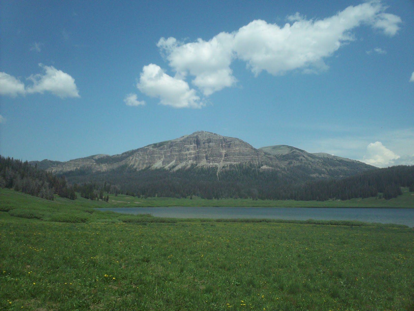
07.27.13 Scapegoat Mountain Palisades, 37 miles, 5500', 8h:
North Fork Blackfoot trailhead to North Fork Cabin, up the Dry Fork, up Cabin Creek, down Dabrota Creek, down the North Fork Blackfoot, past North Fork Falls, and back to the trailhead.

The run to the cabin went quickly enough, and I was consciously keeping 10 minute pace, trying to be conservative since the run was the longest I've done by a fair margin.  Continuing up the Dry Fork, the trail stayed good, and the running was easy.  Made it to Cabin Creek at mile 10 in exactly 100 minutes, and from there turned northeast towards Scapegoat Mountain, which was visible 8 miles distant.  The Cabin Creek trail was not so good, and had much deadfall and fairly indistinct track.  Also, no one had been on it in a good while.  The trail follows a bench, and much like everywhere else in the Scapegoat, is surrounded by 25 year old trees. 

The creek bottom itself looked like good bear habitat, willows and patchy unburned timber with avalanche paths reaching the creek in a number of places, but the trail was following a bench, and I was glad to not be down there.  Predictably however, after two miles, the trail dropped into the head high willows, and the bear sign started appearing.  At first, it was mostly older scat, grizzly for sure, but not fresh.  As I progressed up the trail, it became fresher and fresher, until I found one that was certainly from the night before or that morning, as well as some rubs, and my hackles started rising.  So I did the only sensible thing, which was to stop running, and start walking slowly, making a lot of noise, and paying close attention to what was going on in the bushes around me.  And so I trod lightly for the next five miles, until the trail started climbing up out of the creek bottom.  Now, I'm generally cool with bears, but Cabin Creek made me uncomfortable.  Perhaps it was the remoteness, or the confining vegetation, or whatever, but it had me spooked, and I was relieved to get to the headwall.

The climb up to the Cabin-Dabrota divide was easy and the trail was good and distinct.  The wildflowers in the Scapegoat are in full effect right now, and the giant limestone palisades of Scapegoat Mountain along with the bursting Paintbrushes was classic Montana.
Wildflowers and a little piece of Scapegoat Mountain.

Cabin Creek

Scapegoat Palisades and Flint Mountain.
The run down Dabrota Creek to the North Fork was fast and nice through unburned forest (the only such of the route).  From there it was 13 miles back to the truck through burned, shadeless, south facing hillsides in the 90 degree heat of the day.  This bit was a slog, and I was tired and hot (but still running) upon reaching the truck.  I wish my legs had been a bit more cooperative towards the end, but they've never gone that far before.  Looking forward to trying a route of this length again, now that I know what I'm in for. 

07.28.13 N Sentinel/University Mountain/Crazy Canyon, 10 miles, 3000', 1h40m:
Slow recovery jog around the Sentinel Massif.  Felt surprisingly good after yesterday's long run.  Eating fish helps every time.


Monday, July 22, 2013

In the Missions and the Swans.

Closed out the week with three more outings for a weekly total of ~90 miles and ~27000' vertical.

I was quite tired from Pyramid Buttes Sweeney on Thursday, and just did a short run to the top of Sentinel on Friday with Louie.  He really has a hard time with the heat.  Even in the evening it's been in the mid to high 70s, and he can't deal with that.  So we went slowly.

07.20.13 Greywolf Peak, 14 miles, 6000', 9h:
On Saturday, I met up with friends Perry and Clair for an attempt on Greywolf Peak.  This spring, Perry and I skied Greywolf's classic west couloir, but this line does not include a summit visit.  This time we were hoping to climb the northeast ridge, which is the standard summer route. 

The trail from Twin Lakes was good (and clandestine), with minimal deadfall due to some kind and good person who cut out much of the lower trail.  I'm hoping to return this fall and finish cutting out the upper sections of the trail.  Formal trail maintenance?  The tribal side of the Missions have about three maintained trails, and these mostly stick to the lower country.  Anything that heads to a peak is covertly cleared by the dedicated group of skiers that frequent this range.  We climbed a ways through the timber, before crossing below a steep open fin (where a snowshoer was killed in an avalanche a number of years ago), and got this view:
Greywolf's south couloir.
The south couloir almost looked skiable still.  There is still a surprising amount of snow in the Missions.  More on that in a minute.  As we made our way up the basin, we were overcome by patriotism on account of this American Bald.
Majestic American Bald.
 I even took off my hat for a minute, at great risk of sunburn.  We crossed the Grizzly Lakes basin to a low pass in the southeast ridge:
Greywolf's SE ridge.
 After this, one must then cross the Scenic Lakes basin, and climb up onto a shelf to the northeast of Greywolf via a little 3rd class gully.  From there we made our way to the crux of the route, called the Notch, where the shelf gives way to the proper northeast ridge of Greywolf.  This section is typically rated high 4th class in ideal conditions.  I had already seen a bunch of snow in the notch, and also some snow peaking over the ridgeline, which did not inspire confidence, as we hadn't brought crampons or axes.  Sure enough, after descending some difficult rock, and crossing an airy catwalk to the notch proper, we found this enormous cornice still fully in play, effectively blocking the route through the notch:

Perry assessing the feasibility of downclimbing around the giant death cornice via its moaty bowels.
The pictures don't really do justice to the consequences of this terrain.  If one fell in either direction crossing that snow, death was pretty certain.  There was also a significant amount of snow still on the north ridge.  It would have been easy to navigate with crampons and an axe, but not being so equipped, the combination of exposure, difficult climbing, and non-ideal conditions provoked the decision to call it quits on the summit bid.  Despite being turned around 500' from the summit, the views were spectacular, and the journey to the notch is well worth the trip.  There is still so much snow in the Missions!  A dedicated skier could easily get several thousand feet of corn skiing in, and it's almost August.
Upper 4th class on the other side of the notch.

   
Airy sidewalks.
  
07.21.13 Holland Lake Loop, Somewhere between 24 and 28 miles, 7000', 5h05m:
I felt quite good after the hike up Greywolf, and decided to go for a longer run on Sunday.  I feel as though I've been doing alot of scrambling lately, which translates to alot of not running on these outings.  Thus, I resolved to go somewhere with trails the whole way, specifically trails that likely have been cleared in the last 2 years, so that I could see what it feels like to run continuously for the kind of distances I'm going to see in the upcoming race.  I was also inspired by the previous day's view of the incomparable Swan front to visit that range.  Holland Lake is a major access point, and I was able to determine a desirable loop route that would pass by three sets of jewelry themed lakes, as well as visit a decommisioned lookout. 

The drive from Missoula was long, and it was almost 9 by the time I left the truck.  I ran hard out of the gate and made it to Upper Holland Lake in about an hour, trying hard to push through the steeper technical sections.  From Upper Holland, it's only another 600' vertical to the first pass of the day, Pendant Pass, from which views of the interesting geology of Carmine Peak are excellent.
Belt shales on Carmine Peak.
From Pendant Pass, it was a fast and rocky schuess down to Big Salmon Creek with occasional views of red rocky breaks.  This was my first time in the Bob Marshall proper, and I am now really looking forward to coming back and fishing the lakes and these medium-sized creeks.  At the intersection of Big Salmon Creek and Smoky Creek (my route back up to the front), I ran into a giant party of hung-over cowboys, all of whom were wearing 10 gallon hats, chaps, sleeveless T-shirts, and pistols.  They were arranged in a giant dirt circle, and gave me hard looks when I ran past.  The run up Smoky Creek was standard fare until reaching the Necklace Lakes, when the timber opened up offering views north to Buck and Holland Peaks.
Buck.

Holland and friends.
Another 20 minutes had me on Necklace Pass, where a really steep and narrow spur trail takes off to the old Holland Lake lookout at 8000'.  This was my only walking of the day, which was really nice.  From the lookout, the amount of snow remaining in the southern Missions is obvious.  There remain several thousands of feet of snow below the Glacier Peaks (second from right in the snowy group), and on the East Face of MacDonald (rightmost member of the snowy group). 
Snow in the Southern Missions.

 Although these peaks are not much higher than the Swan crest, the amount of snow ice decidedly different, as is obvious by these views north and south.

North along the crest.

South along the crest.

Perhaps it's a lake effect thing, or maybe a function of the local topography (the Missions have lots of little bedrock undulations that trap drifts). 

The route from the lookout back to the trailhead is 4000' of technical running down loose dirt and bedrock steps, past the lovely Sapphire Lakes, Upper Holland Lake again, and the huddling masses ascending the trail at 1:00 in the afternoon in 90' heat.  I was slowed briefly by the same cowboys I had encountered earlier as they parked on the trail while deliberating which fork to take.  My legs were pretty well spent by the time I exited the Holland Creek canyon and the heat was extreme, and the last mile was rather uncomfortable, but I guess that's to be expected.
  

Thursday, July 18, 2013

Running race courses and continued gendarmigans.

After my brush laden, deadfall jumping, gendarme frustrated voyage of 30 miles through the backcountry of Idaho and Montana on Saturday, I took a day off on Sunday to collect firewood, and had a 6 mile, 1400' run up and over Sentinel on Monday.

07.16.13 Double Dip, 13 miles, 3000', 1h50m: 
On Tuesday I opted to keep it close to home and ran the Pengelly Double Dip course, a "Tall Half-Marathon," as they say.  I didn't even know this race existed until I accidentally ran a similar course a few minutes ahead of the race itself, and all of a sudden all these people jumped out with cowbells and started banging them at me.  WTF, super-stoked old guy?  The course consists of running up the M trail, around the Crooked trail, up Chopsticks, to the top of University, then back down to the saddle, then up Sentinel, down Smokejumper, and back to the start.  Due to my geographic condition, I started (and ended) the route on Crooked.  I ate too much hazelnut butter for breakfast, drank not enough water, and started at 10AM when it was already 80 degrees.  This was a recipe for cramps, and they started almost immediately upon beginning my descent from University.  By the bottom of Smokejumper's they were bad and slowed me down quite a bit.  I stopped my watch for a few minutes while sitting by the spring on Kim Williams trying to convince my gut to settle down, but my ailment returned even after this break.  I felt fine ascending the M trail, and even made this climb rather quickly, but then cramps again on the flats.  I'm certain I could run this quite a bit faster if I were feeling well, and look forward to trying again.

07.17.13 Fartlek to Crazy Canyon, 6 miles, maybe 1000', 48m:
Continuing to try this periodic sprinting thing.  I think my shoes wore out last week, because I really felt this one.  Maximum velocity running on a rocky road with packed-out minimal-type footwear is incompatible with my physiology.

07.18.13 Pyramid Buttes to Sweeney peak, ~18 miles, ~7000', 5h40m:
This was one of my favorite runs ever.  It went like this: First, I summited Middle Pyramid Butte, then descended to Mills and Holloway Lakes before contouring around a rocky ridge into the next basin to the North across some really fun 3rd class slab stuff to hit the Sweeney-S. Fork Lolo drainage divide above Duffy Lake.  Next was an unnamed high point with dubious passage on its non-visible north side (it went), followed by a descent to a really neat unnamed tarn just south of the Sweeney ridge.  From here I made a steep climb up big talus to the Sweeney ridge, and proceeded to engage in some Krumholz-whacken (no English translation is possible) and gendarme avoidance, interspersed with the occasional running gait to the Sweeney summit, before a quick descent back to the trailhead.  The rock along the Sweeney headwall is an extra flashy brand of red schist, with big sticky crystals, and it's fun to climb on.  The route goes surprisingly cleanly (even the downclimbing around gendarmes!), and something about the more technical and challenging descent and ascent lines is ... aesthetic?  Looking forward to discovering more routes like this in the Root.  They're there, but you gotta find 'em.
East Pyramid Butte Ridgeline and Big Joe.

Descent ridge to unnamed tarn below Sweeney Ridge.

Unnamed tarn.


Sunday, July 14, 2013

Long runs in the Snakes and the Roots.

I finished out my week with two long runs with very different characters.
Cumulative weekly stats: 90 miles, 22hrs, 25000' of gain.

7.11 Stuart Peak, 19 miles, 4600', 3:05:
Morning cruise to the top of Stuart Peak and back.  This trail is really perfect for moving quickly.  There are no rocks, the grade is pretty uniform, minimal deadfall, and no views before the summit.  I used the descent to work on maintaining a sustained fast pace, averaging between 6 and 7 minute miles, which is really fast for me, and felt surprising good at the end.

7.13 Bear Creek to Big Creek via Idaho, 31 miles, 8500', 9:30:
This is a logical albeit difficult run that connects two of the bigger Bitterroot drainages.  I left my road bike at the Big Creek trailhead locked to a hitching post before starting up the Bear Creek trailhead 13 miles distant.  I headed up the alternately rocky and smooth trail, climbing over occasional deadfall.  Despite this being a popular trail, it has not yet been cleared.  I made it to Bryan Lake in a bit under 2 hours (8ish miles, 3000'):
Granite above Bryan Lake.
 My energy level was pretty low at the start of the day, maybe from the fast running of the previous few days, and my legs were...  balky?  They felt better after the lake and drinking alot of water.  I made the class 2-3 climb up the west ridge on Sky Pilot and hit the summit at 3 hours flat.  Henceforth, the route was terra incognita.  Descending into the unnamed creek from Bear Creek Pass was fine, with just a little bit of talus hopping to avoid some large snow patches.  Once off the headwall, the trail was decent, but starting to become overgrown, and I had to backtrack more than once after going off on game trails that were more distinct than the real trail.  The views were lovely though, and it was fun to be so far back in a place that I can basically guarantee no one has visited yet this year:

Unnamed peaks in the Lochsa's headwaters.

Deadfall here was managable until the 6000' level, where both the deadfall and the overgrowth of the Idaho jungle into the trail made things slightly difficult. I was expecting the trail up Packbox Creek to be better, since it is ostensibly the more popular point of access between Montana and Idaho.  I came to learn that this is not the case, and that neither trail has been cleared in a number of years.  Packbox Creek's trail was very difficult.  Whatever drainage structures existed have become useless, and the amount of brush encroaching on the trail made running impossible.  I felt like I was walking through a creek bed, but it wasn't possible to say for certain because I couldn't see my feet.  In many places, the trail was incised two feet.  Additionally, there were more than fifty trees over the trail.  Alas, I eventually made it above the brush line and resolved to run the remaining 1000' of steepish vertical up to Packbox Pass, simply because I had not been able to at all down lower.   
Neat tree on Packbox pass.
I had intended to try and follow the ridge from the pass back to Ranger Peak, but had known from the outset that it might not go.  This was confirmed upon attaining the first highpoint along the route:

The ridgeline to Ranger Point was guarded by many unavoidable 5th class gendarmes.  I hemmed and hawed a little bit before admitting that the exposure was more than I was comfortable with, given my fatigue level.  So I enjoyed the views and started descending towards Big Creek Lake (Reservoir?):

Big Creek Lake

This was the worst section of the trail for deadfall, in some places stacked 10 feet high, with thick brush precluding going around.  I would guess another fifty trees need cutting in this 1 or 2 mile long stretch.  I ran into an old time Bitterroot horseman camped on Big Creek Lake, and we had a good discussion about trail maintenance and federal funding for trail maintenance.  We agreed that the route I had just taken should be a priority for trail work, for a few reasons:  First, all the trails are stock-suitable (were they maintained properly), and having this clear would provide an excellent loop for horsepackers and backpackers.  This is some of the most scenic country in the Bitterroot, after all.  Second, clearing this loop would provide two great access points into the Idaho side, which would expand possibilities for outfitters and recreationalists alike, especially since the trails down towards the Colt Killed trailheads do get maintained.  Finally, the amount of work necessary to get these trails in working order, though non-trivial, would not be prohibitive.  An MCC crew could get it done in a hitch or two, by my estimation, and according to Jim it would be easy to get pack support from the Montana Backcountry Horsemen.  The rock work is excellent because these trails were built long ago by people who wanted them to last.  There's plenty of good tread and good structures; if the trails don't get fixed up soon, these may be lost to vegetation.

The last ten miles to the Big Creek trailhead were rather slow and painful.  Fatigue had overtaken me quite suddenly upon reaching the dam at the bottom of Big Creek, and the trail was rocky and technical much of the time.  My knees were really feeling the constant gait changes.

At the TH I was happy to see that no one had stolen or vandalized my bike.  The ride back to the truck was deliberately slow, taking over an hour to make the 13 miles over both washboarded dirt roads, loose gravel (grr.), and nice pavement, for a total of 44 miles worth of human-powered propulsion for the day.  

Wednesday, July 10, 2013

Official training.


I've now officially registered to run The Rut 50k on September 15th at Big Sky, which means that I have to stop having fun and start training.  Whatever that means.

I've started trying to incorporate some Fartlek into my week, particularly on mornings when I don't have time for a long run.  In particular I'm trying to alternate a few hundred yards of maximum speed with a few minutes of moderate jogging.  Sprinting is quite painful for me still, and I'm much more worked after 6 miles of this than after yesterday's much more objectively taxing run up Lolo Peak, even though on average I was only hitting 8 minute miles (on average).  This slowly learning to run fast seems like a good way to learn how to run slowly faster(?).   

Tuesday, July 9, 2013

Two new Bitterroot summits.

7.7 Castle Crag - 15 miles, 4900', 4:30:
On Sunday I ran to the summit of Castle Crag via Sheafman Creek northwest of Hamilton.  The run to the lakes at the head of Sheafman was straightforward, albeit with several creek crossings, some serious bogs, and many roots and downed trees.  Those are the things that make it interesting.   From Knaack Lake, I ascended a talus slope, and then climbed good granite talus bolders to the summit at just under 9000', losing elevation a few times to avoid gendarmes.  On the descent, I opted for a short section of very low 5th class, just for kicks and to stay near the ridge.  I descended to Aichele Lake via a short and steep-ish couloir.  From there it was a straightforward run out, with plenty of highstepping over mud and roots.  I felt really good on this one all day until the last 3 miles, when the mid-day heat caught up to me and I realized I hadn't had enough to drink.  I'm continually surprised by how much hydration can affect the way my joints feel, as well as my fatigue the next day.
The precipitous 500' East Face of Castle Crag.

Good granite at the head of Sheafman Creek. 
 7.8 Gully Loop - 4 miles, 900', 0:45:
I was surprisingly tired from the previous day's run, so I took a very leisurely jog up to the saddle between University and Sentinel via the draw and down the Sentinel road.


7.9 Lolo Peak - 16 miles, 5200', 3:35:

Early morning run up and down the most dominant feature (arguably) in Missoula's viewshed.  Despite living here for 6 years, this was my first time to this summit, partially because it's so close and visible (although that's not really valid; I've been up Stuart Peak probably 6 times).  It's definitely as worthy as anything else in the Root, and it's close enough to hit before or after work.  Ran every step of the 2400' climb to Carlton Ridge, and continued down to Carlton Lake.  I foolishly took the Summitpost route here, over the dam and to the low pass between Carlton Creek and One Horse Creek before gaining the ridge.  This takes you in the entirely wrong direction, adds more than a mile and an extra 500' of gain, along with some krumholz-whacking and gendarme skirting.  If I had made the sensible choice to go directly up the northeast face, I am certain this run would have gone in under 3 hours.  Next time.  Views from the top were good, with Big Joe especially prominent to the south.  What a mountain that is, almost invisible from the valley floor but 600' higher than anything in the range and massive.  Things seemed pretty hazy, and I could only vaguely see the Missions and the Swans.  Smoke season, I guess.  Descended back to Carlton Lake via the correct route, and ran 6-7 minute pace (which is pretty fast turnover for my uninitiated legs) down the switchbacks to the truck, and was back in Missoula working by 11.    
 
Cornices and Big Joe.


Monday, July 8, 2013

The reverse Q continues: A double crossing of the Tetons and fireworks.

For you folks who grew up doing vaguely outdoorsy things, do you have a particular region that imparts a sense of overwhelming nostalgia?  I do, and for me it's the northern part of the Idaho-Wyoming border (including the Tetons and the Yellowstone's cascade corner, to Alpine Canyon and the Big Holes).  In addition to learning to ski at Grand Targhee, Kelly Canyon, and Alpine Village, I did my first backpacking trip to Dunanda Falls and my first notable mountain hike to Table Mountain.  I like the geology, the vegetation, the animals, and the rocks, and I like that the particular combination can invoke memories unlike anywhere else.  So with that in mind, I decided to construct a trail running route that would allow me to hit Table Mountain and Alpine Village, get nice views of the big mountains, be difficult enough for my present tastes, and hang out with my folks.  My plan was to drive to the Teton Canyon trailhead, while my folks drove their motorhome to String Lake, on the other side of the Tetons.  I would run up Table Mountain, go off trail the steep mile or so down to the S. Fork of Cascade Canyon, and out the canyon to meet them.  This run was around 14 miles with 4700' of cumulative gain.  The next day would be spent around GTNP and the surrounding area.  Then the morning after that (July 4th!), I would take the tram from Alpine Village to the top of Rendezvous Mountain, and run back to my truck along the Teton crest, for around 19 miles and 3500' of gain.

I left Idaho Falls at 6, and left the trailhead at 7:30.  I took the West Face trail, which is very steep, far too steep to run efficiently.  Thus, I marched the first 2500' of vertical.  After that, the route moderates considerably, and I was able to run most of the remaining 1600'. 


I reached the table mountain summit at 8:50, for a 1:20 split for 4100' vertical and just under 4 miles.  Running at 10000' is hard when you're not used to it (and I'm not).

     The view from Table Mountain was characteristically excellent.  There were several marmots sitting on the summit that were only mildly concerned about seeing me.  I didn't wait long, since the only trail-less, beta-less section of the route was immediately ahead.
Climbing down to the saddle South of Table was a little scary.  I ended up doing some 4th class down-climbing along the wall of a snow-filled gully for several hundred feet.  The rock was poor and most solid surface were covered with slippery gravel.  It went slowly, but it went.  Fortunately, immediately afterwards, I was treated to a magical glissade down two snowy bowls, before having to do some mild bushwhacking to reach the S. Fork Cascade trail. 
After reaching the trail, things went quickly and easily.  Cascade Canyon is very beautiful, and has many interesting waterfalls.
It's also really crowded below the confluence of the two forks.  I passed probably a hundred people over this four mile stretch.  Human-dodging can really slow a run down, I realize, especially when you're trying to duck and weave through the whole family, including Grandma.  I got many a look askance.  Despite the crowds, I ran into a bear on the cutoff trail to String Lake.
He was ripping trees apart and didn't give a shit.  I waited for fifteen minutes or so while he got out of the way.  When I got to String Lake, I went swimming and then went to find the folks.  Total time was just under 4 hours.
We spent the next day and a half cruising around the park and surroundings trying to beat the heat and the crowds.  My dad worked for the Forest Service out here for 5 years in the seventies, and he knew lots of interesting places to go off the beaten path.  Brooks Lake, off of Togwotee Pass, was one example.
It was clear that he too was feeling nostalgic about the region, and related a number of humorous stories about his work here, about getting stalked by grizzly bears, and so forth.  My favorite was about when he tried to kayak the Buffalo Fork but got caught in one of its ubiquitous log jams and had a near-death experience before scrabbling to the water surface only to plant his face in a deer carcass.  I've yet to have anything that picturesque happen to me.

On the 4th of July, I took the tram to the top of the ski resort, and left the tram dock at 9:40
I immediately dropped 2000' into Granite Canyon, before crossing a series of basins to get to Fox Creek Pass.
Almost the entire route was near or above treeline, which was neat.  From here, I ran along Death Canyon Shelf, and got some nice views of the backside of the Cathedral Group.

At Mt. Meek Divide, the shelf turns from NE to NW, and heads down Teton Canyon.  I was bonking pretty hard at this point from the heat, altitude, and not drinking sufficient water, but the shelf drops quickly, and soon I was at the Devil's stairs and then at the bottom of Teton Canyon for the last couple miles to the truck.

Total time for this run was also approximately 4 hours.  I soaked the legs in Teton Creek for a minute, ate a marginal Reuben at some faux-quality place in Victor, then drove back to IF.

Idaho Falls has a big fireworks display because the CEO of a placebo health products company (who loves the shit out of Mitt Romney, incidentally) pays for one out of pocket.  It's really big and impressive, but this year the start was delayed until 11PM because a fellow about my age drowned while trying to swim out to an island in the Snake river.  There were divers sent to recover the body, and they couldn't dive with a massive fireworks display going on overhead.  Morbidly, I was reminded of the beginning of Twain's Huckleberry Finn, where shooting a cannon over the surface of the river is used to aid in body recovery.  I wondered if a powerful firework is like a cannonball in this regard.  Then I got the heeby-jeebies.

I had intended to run in Yellowstone on the 6th, but I was feeling antsy by noon on the 5th.  As I mentioned, I don't trust my garden timer, and I wanted to get home in order to save as many vegetables as possible in the event that it had mutinied.  Louie and I got as far as the Madison River, where I had hoped to do some fishing, but there were thousands of people lining the banks and floating in expensive identical driftboats, so after spending the night in the truck bed at a trailhead because all the campgrounds were comically full, we had a morning hike and drove home.  And the vegetables were fine!  Albeit, the spinach had bolted, and the broccoli was well on its way, but what can you do?  


Sunday, July 7, 2013

A reversed Q with a long tail reaching all the way to California: a roadtrip through the American West.

This is my first post on my new web log, which I intend to use as an irregular and potentially fictionalized instruction manual for doing the same stuff that I do, between 1 and 60 days after I've already done it, or potentially as a soapbox for sharing the good ideas of others and the usually bad ideas of mine.  The subject matter may be subject to large conceptual swings, but will likely involve accounts of ski misadventures, Python code snippets, U.S. environmental policy rants, running until uncomfortable, and my dog's odd behaviour.  Like all good vegetables, the content will be seasonal. 

Which reminds me of this stupid and rather slick timer that Molly and I purchased two weeks ago.  It's a garden timer, and it does everything you would want it to, such as turn on the water to your garden when you are not home, at specified times and durations.  That's actually all.  It's perfectly executed minimalism (OK, elegance, goddammit.) makes me ill, and that's because it eliminates the time honored necessity of enacting some mechanical voudon ritual of cursing, manual reading, waiting all day to see if it works, and because it's connected to an active hose, getting sprayed several times.  It actually didn't even come with a manual because you just press like three buttons and it works.  So it shouldn't be surprising that I had no faith in this machine.  We bought it because we were going on a ten-day trip through Idaho and California, and we needed it to water our garden, but I was really concerned the entire time that it would fail, vindictively, in the midst of the agonizingly long, hot, and sunny high pressure system plaguing the western states (known as summer to laymen). 

As it turns out, when people like each other enough, they often feel compelled to throw big parties and make promises to each other, and right in the middle of these hot spells is when they like to do it, because nobody likes getting married in the rain, I guess.  Friends Ryan and Liza decided that they did indeed like each other enough to make it official so that's why Molly and I decided to head to the Californian North.  Driving to Boise was uneventful enough.  It was, as always, a treat to drive by the N. Fork of the Payette to look at its impressive whitewater (the phrase ultra-classic comes to mind).  I stopped several times to look at the rapids, telling Molly that it's because Louie needed to pee.  He can hold it for like 12 hours though, so I doubt she believed me.  I'm really looking forward to coming back to run it (or get scared and run away like a cretin) in late July.  I really hate dams and this one is no exception, but the fact that this river is dam-controlled is dam convenient.  I can think of few other Class V rivers in the northwest that run all summer.  I guess convenience is what dams are all about.

Being able to stay in Boise was clutch.  Missoula to Shasta in a day is excessive if you like to fall asleep while driving like me.  My climbing partner Casey and I had intended to climb Mt. Shasta on Thursday the 28th of June, but gusts were forecasted to 90mph on the upper mountain that day, so we delayed until the 29th.  This was really nice anyway, since long drives followed by alpine starts are notoriously unpleasant.  By the way, have you ever been in 90mph winds?  I haven't, but I've felt as much as 70mph near the summit of Little St. Joe.  At that level of wind, it's pretty difficult to walk, and you have to expend quite a bit of energy stabilizing yourself.  Forecasts for the 29th were much nicer, so instead of climbing Mt. Shasta, we spent the day getting views of the Castle Crags and sitting in Lake Siskiyou, on what felt like the first really hot day of the year.

The next morning Casey and I climbed Mt. Shasta and it was good.  We woke at 2, ate eggs, left the house we were staying at around 2:30, and were leaving the car at Bunny Flats (6900') at around 3:30.  We decided to climb via the West Face Gully route (WFG), which is a slightly longer alternative to the standard Avy Gulch route, but departs from the same trailhead.  The split in route occurs at the famous Horse Camp, where our trail started a climbing traverse under Casaval Ridge to Hidden Valley, a lovely flat at around 9200'.  I think it took us about an hour to make it to Hidden Valley, and by 5, we were donning crampons (over running shoes) to begin the snow climb.  The crux section of the route (if you can really call it that) is right at the beginning, where you have to climb a little pitch of 38 or 40 degree snow.  The snow was still hard-frozen, so we were up on front points.  Regrettably, my crampon bar flexed its way out of the adjustment mechanism, and popped in half front to back.  This was concerning because I thought that it was broken (I saw a black piece of something sail down the hill).  I managed to find a moat to sit in (usually not a great idea) while repairing it.  After this, no technical problems occurred (unless you count how extraordinarily uncomfortable it is to wear Grivel G10 crampons over New Balance MT110s.  I need some Kahtoolas).  After the shenanigans the sun started coming up, and we got a good view of a neat phenomenon that really only happens at 11000' on a volcano.  It looked like this:
which is the shadow of Mt. Shasta stretching off into the distance, and even onto the atmospheric haze.  It was also at this time that I realized how hip Casey looked in running shoes and bicycle helmet:
  The guys in the background were pretty teched out.  One of them even had a rope slung euro-style around his shoulder, and was duck-walking stalwartly.  I was glad to be carrying only 10lbs. of stuff.  Those dudes looked miserable.  Anyways, we hit the plateau below misery hill (13500' or so) at 7 or so. 
 We were in high spirits, particularly bolstered by the discovery that mountaineering is much more fun if you speak in European accents and quote Ueli Steck alot.  Misery hill was lower angle than the WFG and had a nice switchbacking trail up to the summit plateau, which looked like this:
 We passed another pair of climbers while ascending misery hill, but they did not answer our hails; they had gone full zombie.  From the summit plateau, it was a straightforward stroll to the true summit.  We topped out at 7:40, 4:10 after leaving the parking lot, and talked to a pair of gentlemen from San Francisco who had camped at Helen Lake and were the first to make the summit that day.

The descent was straightforward.  I encountered the zombies we had seen on Misery Hill on the summit plateau.  The one was like "Is that the real summit, man?  We've already been tricked so many times" and the second one said "At what elevation do we begin to glissade?"  I like to reimagine the first one in the voice of Doctor Gonzo, and the second from a jaw-clenched-on-cigarette-holder Hunter Thompson.  We waited for about 15 minutes at the top of the WFG to avoid kicking ice down on some young climbers that were almost there.  Regrettably, because we were descending so early in the day, we were only able to glissade perhaps 500' of the whole route.  On the other hand, because everything was still frozen, we saw only one human-head size clump of volcanic bullshit hurtling down the hill near terminal velocity.  I was slow downclimbing the crux because I get scared easily, but I pushed through knowing that at the bottom I would get to take off my crampons.  After crampon removal, we alternated running and walking, then just walking, back to the car.  On the way down we passed probably 50 people with big backpacks wearing Asolo boots, presumably most on their way to Helen Lake to camp for a summit attempt the next day.  It was really nice to have gone on a lower pressure day via a lower pressure route.  I don't think I could deal with the types of crowds that Avy Gulch was certain to have on a sunny Saturday.  We arrived back at the car at 11 almost exactly, for a total car to car time of approximately 7:30, and more importantly, in time to make it back to town for lunch at a decent hour.

More swimming the next day, and then the wedding (which was quite lovely with the arch thing framing Mt. Shasta), then the reception, and then Molly and I drove back to Boise the next day.  Molly was staying in Idaho to guide rafts, so we said goodbye, and I headed on to Idaho Falls (the Motherland) for some trail running in Le Tetons and some deluxe camping in Jackson's Hole, among other things which will be covered in the next entry.